Area Overview for IP22 2BW
Photos of IP22 2BW
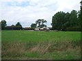
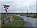
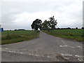
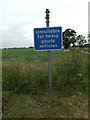
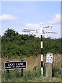

22 photos from this area
Area Information
Key information about the IP22 2BW including its size, population, and administrative classification.
- Area Type
- Postcode
- Area Size
- 1.0 km²
- Population
- 1236
- Population Density
- 54 people/km²
House Prices in IP22 2BW
13
Properties
£333,650
Average Sold Price
£76,000
Lowest Price
£625,000
Highest Price
Showing 13 properties
| Address | Type | Beds | Baths | Last Sale Price | Last Sale Date | |
|---|---|---|---|---|---|---|
| Sunrise, Stone Lane, Bressingham, IP22 2BW | Bungalow | - | - | £625,000 | Nov 2022 | |
| Deveraux House, Stone Lane, Bressingham, IP22 2BW | house | - | - | £622,000 | Jul 2022 | |
| High Oak Farm, Stone Lane, Bressingham, IP22 2BW | house | - | - | £162,500 | Jun 2016 | |
| Thornberries, Stone Lane, Bressingham, IP22 2BW | Detached | - | - | £182,750 | Jun 2008 | |
| Willow Bank Farm, Airfield Road, Kenninghall, IP22 2BW | Detached | - | - | £76,000 | Jun 1995 | |
| Sycamore Barn, Stone Lane, Bressingham, IP22 2BW | Detached | 3 | 3 | - | - | |
| Stone Lane Barn, Stone Lane, Bressingham, IP22 2BW | Bungalow | - | - | - | - | |
| Unit 2, Poplar Tree Farm, Stone Lane, Bressingham, IP22 2BW | Detached | - | - | - | - | |
| Mobile Home At, Deveraux House, Stone Lane, Bressingham, IP22 2BW | Mobile Home | - | - | - | - | |
| Stone Lane Farm, Stone Lane, Bressingham, IP22 2BW | Detached | - | - | - | - |
Page 1 of 2
Energy Efficiency in IP22 2BW
Amenities
Schools
| Rank | School | Type | Entry gender | Ages |
|---|
Explore more schools in this area
Go to Schools tabDemographics
Household Size
Two person
most common
Accommodation Type
Houses
most common
Tenure
80
majority
Ethnic Group
White
most common
Religion
N/A
most common
Household Composition
N/A
most common
Age
47
median
Adults (30-64 years)
most common
Household Deprivation
N/A
with no deprivation
NS-SEC
33
in Lower managerial occupations
Explore more demographic insights in this area
Go to Demographics tabPlanning
Planning Constraints
- Flood RiskPremium
- Ramsar Wetland SitesPremium
- Area of Outstanding Natural BeautyPremium
- Protected Nature ReservePremium
- Protected WoodlandPremium