Area Overview for IP22 1SL
Photos of IP22 1SL
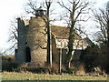
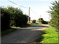
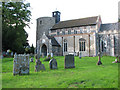
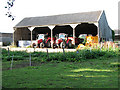
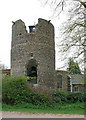
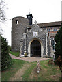
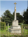
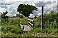
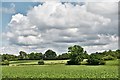
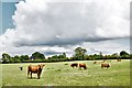
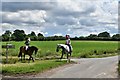
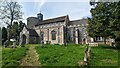
76 photos from this area
Area Information
Key information about the IP22 1SL including its size, population, and administrative classification.
- Area Type
- Postcode
- Area Size
- 67.5 hectares
- Population
- 1435
- Population Density
- 54 people/km²
House Prices in IP22 1SL
16
Properties
£594,400
Average Sold Price
£430,000
Lowest Price
£772,000
Highest Price
Showing 16 properties
| Address | Type | Beds | Baths | Last Sale Price | Last Sale Date | |
|---|---|---|---|---|---|---|
| The Old Rectory, Rectory Road, Wortham, IP22 1SL | Detached | 6 | 2 | £772,000 | Feb 2024 | |
| Wortham House, Rectory Road, Wortham, IP22 1SL | Detached | - | - | £740,000 | Mar 2021 | |
| Hill House, Rectory Road, Wortham, IP22 1SL | house | - | - | £430,000 | Nov 2015 | |
| The Wigwam, Rectory Road, Wortham, IP22 1SL | Detached | 5 | 2 | £590,000 | Nov 2014 | |
| The Coach House, Rectory Road, Wortham, IP22 1SL | Detached | - | - | £440,000 | Feb 2001 | |
| 1, Rectory Cottage, Rectory Road, Wortham, IP22 1SL | Semi-detached | 3 | 2 | - | - | |
| Annexe At, The Wigwam, Rectory Road, Wortham, IP22 1SL | Detached | - | - | - | - | |
| 2, Rectory Cottage, Rectory Road, Wortham, IP22 1SL | house | - | - | - | - | |
| Hall Farm, Rectory Road, Wortham, IP22 1SL | storage_distribution | - | - | - | - | |
| Annexe At, Wortham House, Rectory Road, Wortham, IP22 1SL | Flat | - | - | - | - |
Page 1 of 2
Energy Efficiency in IP22 1SL
Amenities
Schools
| Rank | School | Type | Entry gender | Ages |
|---|
Explore more schools in this area
Go to Schools tabDemographics
Household Size
Two person
most common
Accommodation Type
Houses
most common
Tenure
81
majority
Ethnic Group
White
most common
Religion
N/A
most common
Household Composition
N/A
most common
Age
47
median
Adults (30-64 years)
most common
Household Deprivation
N/A
with no deprivation
NS-SEC
42
in Lower managerial occupations
Explore more demographic insights in this area
Go to Demographics tabPlanning
Planning Constraints
- Flood RiskPremium
- Ramsar Wetland SitesPremium
- Area of Outstanding Natural BeautyPremium
- Protected Nature ReservePremium
- Protected WoodlandPremium