Area Overview for IP22 1AA
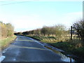
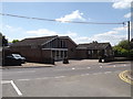
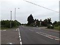
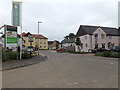
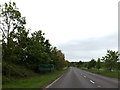
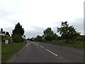
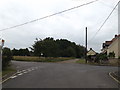
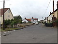
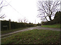
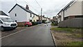
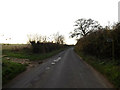
Photos of IP22 1AA

Area Information
Living in IP22 1AA means inhabiting a compact, residential cluster in England’s East of England region. Covering 8.2 hectares, the area is small but well-defined, housing 2,478 residents. With a population density of 86 people per square kilometre, it balances intimacy with practicality. The community is predominantly composed of adults aged 30–64, reflecting a mature, stable demographic. Home ownership is high at 81%, with most properties being houses rather than flats. This suggests a focus on family-oriented living, where space and privacy are prioritised. The area’s low crime risk score of 85 and minimal environmental constraints make it appealing for those seeking safety and ease of planning. Proximity to Diss Railway Station and nearby retail hubs like Morrisons and Tesco adds to its convenience. For buyers, IP22 1AA offers a blend of quiet living and accessible amenities, ideal for professionals or families looking for a settled, low-maintenance environment.
- Area Type
- Postcode
- Area Size
- 8.2 hectares
- Population
- 2478
- Population Density
- 86 people/km²
IP22 1AA is a predominantly owner-occupied area, with 81% of homes owned by residents rather than rented. The housing stock is almost entirely composed of houses, which is unusual for smaller postcode areas and suggests a focus on family living. This makes the area less likely to attract short-term renters or speculative buyers, creating a more stable market for long-term investors. The compact size of the area—just 8.2 hectares—means the housing stock is limited, which could lead to competition among buyers. For those seeking homes in IP22 1AA, the availability of houses may appeal to families or professionals prioritising space and privacy. However, the small footprint also means buyers should consider proximity to surrounding areas for additional options. The high home ownership rate indicates a community with a strong sense of permanence, which can be a positive factor for property value retention.
House Prices in IP22 1AA
Showing 4 properties
| Address | Type | Beds | Baths | Last Sale Price | Last Sale Date | |
|---|---|---|---|---|---|---|
| Bridge Farm, Ling Road, Palgrave, IP22 1AA | Detached | 5 | 1 | - | - | |
| Fettle Barn, Ling Road, Palgrave, IP22 1AA | house | - | - | - | - | |
| Tinkers Barn, Ling Road, Palgrave, IP22 1AA | Bungalow | - | - | - | - | |
| Bridge Farm Cottage, Ling Road, Palgrave, IP22 1AA | Detached | - | - | - | - |
Energy Efficiency in IP22 1AA
Residents of IP22 1AA have access to a range of local amenities within practical reach. The area includes five notable retail outlets, such as Morrisons Diss, Aldi Diss, and Tesco Diss, providing everyday shopping convenience. These stores cater to a variety of needs, from groceries to household goods. The proximity to Diss Railway Station enhances mobility, connecting residents to broader regional networks. While the area lacks large-scale leisure or entertainment venues, the retail options and rail access contribute to a practical, community-focused lifestyle. The compact size of IP22 1AA means amenities are concentrated, reducing travel time for essential services. This setup is ideal for those who prioritise convenience and proximity to daily necessities over expansive leisure facilities.
Amenities
Schools
Residents of IP22 1AA have access to two primary schools within practical reach: Palgrave Church of England Voluntary Controlled Primary School and Palgrave Church of England Primary School. Both are state-funded institutions, with the latter holding a ‘good’ Ofsted rating. The presence of two primary schools suggests a focus on early education, likely serving the needs of families with young children in the area. The ‘good’ rating at Palgrave Church of England Primary School indicates a school with strong performance in key areas such as teaching quality and pupil outcomes. However, the absence of secondary schools or further education institutions in the immediate vicinity means families may need to look to nearby towns for secondary schooling. This could be a consideration for those prioritising a full range of educational options for their children.
| Rank | School | Type | Entry gender | Ages |
|---|
Explore more schools in this area
Go to Schools tabDemographics
The population of IP22 1AA is 2,478, with a median age of 47. This indicates a community skewed towards middle-aged adults, with the most common age range being 30–64. Home ownership is robust at 81%, suggesting a stable, long-term resident base. The area is predominantly occupied by houses, reflecting a preference for single-family dwellings over flats or apartments. The predominant ethnic group is White, though specific data on diversity is not provided. The age profile implies a mix of established families and professionals, with fewer young children or retirees compared to other areas. This demographic structure may influence local services and amenities, with a focus on adult-oriented needs such as commuting infrastructure and retail. The relatively high home ownership rate also points to a community with long-term investment in property, which can stabilise local markets.
Household Size
Accommodation Type
Tenure
Ethnic Group
Religion
Household Composition
Age
Household Deprivation
NS-SEC
Explore more demographic insights in this area
Go to Demographics tabPlanning
Planning Constraints
- Flood RiskPremium
- Ramsar Wetland SitesPremium
- Area of Outstanding Natural BeautyPremium
- Protected Nature ReservePremium
- Protected WoodlandPremium
- Crime & SafetyPremium