Area Overview for IP21 5WU
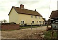
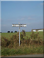
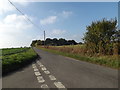
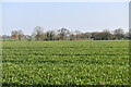
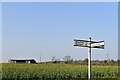
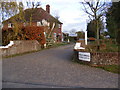
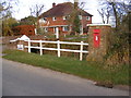
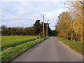
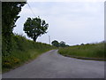
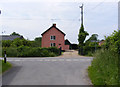
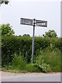
Photos of IP21 5WU

Area Information
IP21 5WU is a small, residential postcode area in England, home to 2036 people spread across a low-density landscape of 40 people per square kilometre. This means the area feels quiet and uncluttered, with a strong sense of community. The cluster of homes here suggests a focus on family living, with many properties likely to be owner-occupied. Daily life in IP21 5WU is shaped by its proximity to local amenities, including five retail outlets such as Budgens Harleston and Spar, which provide essential shopping options. The area’s low population density also implies a slower pace of life, with fewer crowds and a more intimate neighbourhood feel. While it lacks large-scale infrastructure, its compact size ensures that residents can access nearby services without long commutes. The presence of St Edmund’s Primary School, rated ‘good’ by Ofsted, adds to the appeal for families. For those seeking a peaceful, well-connected residential environment, IP21 5WU offers a blend of practicality and community-oriented living.
- Area Type
- Postcode
- Area Size
- Not available
- Population
- 2036
- Population Density
- 40 people/km²
The property market in IP21 5WU is characterised by high home ownership (79%) and a predominance of houses. This suggests a small, established residential area where properties are likely to be family homes rather than flats or apartments. The low population density of 40 people per square kilometre indicates that the housing stock is spread out, potentially offering more private outdoor space. As a small postcode cluster, the market may have limited options, which could make it a niche area for buyers seeking specific properties. The focus on owner-occupation implies a lower rental market presence, though this is not explicitly stated. For buyers, the area’s compact size means that properties are likely to be close to local amenities, but the limited scale of the area may restrict the range of available homes.
House Prices in IP21 5WU
No properties found in this postcode.
Energy Efficiency in IP21 5WU
The lifestyle in IP21 5WU is shaped by its proximity to five retail outlets, including Budgens Harleston, Spar, and the East of England Co-operative Co. These shops provide essential services for daily living, from groceries to general retail, reducing the need for long trips to larger towns. The area’s small size means that these amenities are within practical reach, contributing to a convenient and self-sufficient lifestyle. While there is no mention of parks or leisure facilities in the data, the low population density and residential character suggest that the area may offer green spaces or quiet environments for relaxation. The combination of local shops and a low-key atmosphere makes IP21 5WU suitable for those prioritising ease of access to essentials over large-scale entertainment or commercial hubs.
Amenities
Schools
The nearest school to IP21 5WU is St Edmund’s Primary School, which serves the local community with a ‘good’ Ofsted rating. This school is the primary educational facility in the area, catering to younger children and providing a foundation for local families. The absence of secondary schools or other educational institutions in the data means that students may need to travel to nearby towns for higher education. However, the presence of a well-rated primary school is a significant advantage for families, offering a reliable and quality educational environment. The school’s rating suggests that it meets or exceeds national standards, which can be a key factor for parents considering the area.
| Rank | School | Type | Entry gender | Ages |
|---|
Explore more schools in this area
Go to Schools tabDemographics
The population of IP21 5WU is predominantly adults aged 30–64, with a median age of 47. This suggests a mature, stable community, likely with many long-term residents. Home ownership is high, at 79%, indicating that most residents live in properties they own rather than rent. The accommodation type is primarily houses, which aligns with the area’s low density and residential character. The predominant ethnic group is White, reflecting a homogenous demographic profile. With no data on deprivation levels, it’s unclear how this affects quality of life, but the high home ownership rate and age range imply a relatively stable economic environment. The absence of significant diversity data means the community’s social dynamics are not explicitly detailed, but the focus on family-oriented living—supported by the nearby primary school—suggests a cohesive, localised population.
Household Size
Accommodation Type
Tenure
Ethnic Group
Religion
Household Composition
Age
Household Deprivation
NS-SEC
Explore more demographic insights in this area
Go to Demographics tabPlanning
Planning Constraints
- Flood RiskPremium
- Ramsar Wetland SitesPremium
- Area of Outstanding Natural BeautyPremium
- Protected Nature ReservePremium
- Protected WoodlandPremium