Area Overview for IP20 9NH
Photos of IP20 9NH
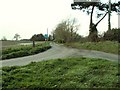
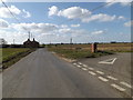
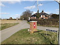
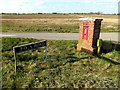
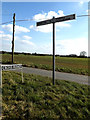
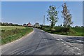
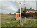
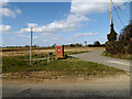

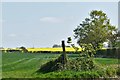
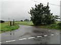
15 photos from this area
Area Information
Key information about the IP20 9NH including its size, population, and administrative classification.
- Area Type
- Postcode
- Area Size
- 74.7 hectares
- Population
- 2293
- Population Density
- 69 people/km²
House Prices in IP20 9NH
17
Properties
£311,700
Average Sold Price
£73,000
Lowest Price
£500,000
Highest Price
Showing 17 properties
| Address | Type | Beds | Baths | Last Sale Price | Last Sale Date | |
|---|---|---|---|---|---|---|
| Pleasure Farm, Cross Road, Starston, IP20 9NH | house | - | - | £500,000 | Mar 2025 | |
| Tyne House, Cross Road, Starston, IP20 9NH | Detached | 4 | 2 | £430,000 | Nov 2017 | |
| 1, Poplar Cottages, Cross Road, Starston, IP20 9NH | Semi-detached | 4 | 2 | £280,000 | Jul 2017 | |
| Houghall, Cross Road, Starston, IP20 9NH | house | - | - | £478,600 | Jul 2017 | |
| Oak Meadow, Cross Road, Starston, IP20 9NH | Detached | - | - | £280,000 | May 2008 | |
| Tuskers, Cross Road, Starston, IP20 9NH | Detached | - | - | £325,000 | Sep 2003 | |
| 2, Poplar Cottages, Cross Road, Starston, IP20 9NH | Semi-detached | - | - | £73,000 | Sep 1999 | |
| Poplars Farm, Cross Road, Starston, IP20 9NH | Bungalow | 4 | - | £127,000 | Aug 1996 | |
| Ambleside, Cross Road, Starston, IP20 9NH | Detached | - | - | - | - | |
| White House Farm, Cross Road, Starston, IP20 9NH | Detached | - | - | - | - |
Page 1 of 2
Energy Efficiency in IP20 9NH
Amenities
Schools
| Rank | School | Type | Entry gender | Ages |
|---|
Explore more schools in this area
Go to Schools tabDemographics
Household Size
Two person
most common
Accommodation Type
Houses
most common
Tenure
70
majority
Ethnic Group
White
most common
Religion
N/A
most common
Household Composition
N/A
most common
Age
47
median
Adults (30-64 years)
most common
Household Deprivation
N/A
with no deprivation
NS-SEC
35
in Lower managerial occupations
Explore more demographic insights in this area
Go to Demographics tabPlanning
Planning Constraints
- Flood RiskPremium
- Ramsar Wetland SitesPremium
- Area of Outstanding Natural BeautyPremium
- Protected Nature ReservePremium
- Protected WoodlandPremium