Area Overview for IP20 9BP
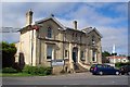
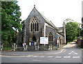
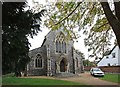
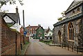
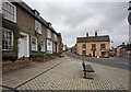
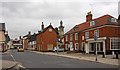
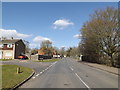
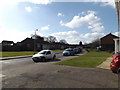
Photos of IP20 9BP
Area Information
Living in IP20 9BP means inhabiting a compact, residential postcode area in England, where 1,495 people reside across 1,716 square metres. The population density of 1,283 people per square kilometre reflects a tightly knit community, ideal for those seeking a close-knit environment. This small area is characterised by its predominantly owner-occupied housing stock, with 69% of homes owned by residents rather than rented. The demographic profile skews towards adults aged 30–64, with a median age of 47, suggesting a stable, family-oriented population. Daily life here is shaped by proximity to local amenities, including three retail outlets like Budgens Harleston and Spar, which cater to immediate needs. The area’s low crime risk, with a safety score of 85, and absence of environmental hazards like flood zones or protected landscapes, make it appealing for families and retirees. However, its limited size means residents must balance convenience with the constraints of a small, densely populated space. For those prioritising safety, community cohesion, and proximity to essential services, IP20 9BP offers a straightforward, practical living experience.
- Area Type
- Postcode
- Area Size
- 1716 m²
- Population
- 1495
- Population Density
- 1283 people/km²
The property market in IP20 9BP is dominated by owner-occupied homes, with 69% of properties owned by residents rather than rented out. This suggests a stable, long-term presence of households, often families, who have invested in their homes. The accommodation type is primarily houses, indicating a lack of high-rise or multi-unit developments. This makes the area attractive to buyers seeking traditional, standalone properties rather than apartments. However, the small size of the postcode area—just 1,716 square metres—means the housing stock is limited, potentially leading to competition among buyers. The high home ownership rate also implies that rental options may be scarce, which could be a consideration for those seeking flexibility. For those prioritising family-friendly living, the mix of houses and the area’s safety profile make it a viable choice, though the compact nature of the area may limit scope for expansion or redevelopment.
House Prices in IP20 9BP
No properties found in this postcode.
Energy Efficiency in IP20 9BP
Residents of IP20 9BP have access to a handful of nearby amenities, primarily focused on retail. Three notable venues include Budgens Harleston, East of England Co-operative Co, and Spar, which provide essential shopping and convenience services. These stores cater to daily needs, from groceries to household items, ensuring residents can manage errands without long commutes. Beyond retail, the area’s limited size means other amenities are sparse, though the presence of schools and low crime risk contributes to a functional, family-friendly environment. The compact nature of the postcode area fosters a sense of community, where local shops and schools become central gathering points. While the selection of dining or leisure options is not specified, the proximity to basic services suggests a practical, no-frills lifestyle. For those prioritising convenience over extensive leisure facilities, IP20 9BP offers a straightforward, service-oriented living experience.
Amenities
Schools
Residents of IP20 9BP have access to three educational institutions within practical reach. Archbishop Sancroft High School serves as a primary school, while Archbishop Sancroft High School (A Church of England Academy) and The Harleston Sancroft Academy (a 3–16 Church of England School) cater to a broader age range, offering both primary and secondary education. These schools are part of the Church of England academy system, which often combines faith-based values with state-funded education. The presence of a 3–16 school suggests a comprehensive educational pathway for families, reducing the need to commute for schooling. However, the data does not provide Ofsted ratings or academic performance metrics, so parents must rely on other factors, such as school philosophy or proximity, when making decisions. The mix of primary and academy schools may appeal to those seeking a structured, faith-informed education environment for their children.
| Rank | School | Type | Entry gender | Ages |
|---|
Explore more schools in this area
Go to Schools tabDemographics
The community in IP20 9BP is predominantly composed of adults aged 30–64, with a median age of 47. This suggests a mature population, likely with established careers and family structures. Home ownership is strong, with 69% of residents owning their homes, a figure that indicates stability and long-term investment in the area. The accommodation type is primarily houses, reflecting a preference for private, standalone properties over flats or apartments. The predominant ethnic group is White, though the data does not specify further diversity metrics. The high population density of 1,283 people per square kilometre implies a compact, possibly suburban or semi-rural layout, where proximity to neighbours is a defining feature. While the area lacks explicit data on deprivation, the combination of high home ownership and low crime risk suggests a relatively affluent or stable demographic. However, the absence of detailed socio-economic breakdowns means any assumptions about quality of life must be tempered by the lack of broader context.
Household Size
Accommodation Type
Tenure
Ethnic Group
Religion
Household Composition
Age
Household Deprivation
NS-SEC
Explore more demographic insights in this area
Go to Demographics tabPlanning
Planning Constraints
- Flood RiskPremium
- Ramsar Wetland SitesPremium
- Area of Outstanding Natural BeautyPremium
- Protected Nature ReservePremium
- Protected WoodlandPremium