Area Overview for IP20 0JE
Photos of IP20 0JE
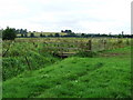
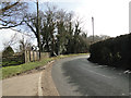
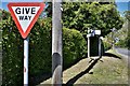
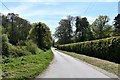
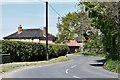
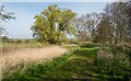
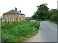

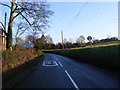
17 photos from this area
Area Information
Key information about the IP20 0JE including its size, population, and administrative classification.
- Area Type
- Postcode
- Area Size
- 6544 m²
- Population
- 2281
- Population Density
- 46 people/km²
House Prices in IP20 0JE
10
Properties
£331,000
Average Sold Price
£248,000
Lowest Price
£383,500
Highest Price
Showing 10 properties
| Address | Type | Beds | Baths | Last Sale Price | Last Sale Date | |
|---|---|---|---|---|---|---|
| The Old Post Office Cottage, Withersdale Street, Mendham, IP20 0JE | Detached | 4 | 3 | £383,500 | Mar 2019 | |
| The Retreat, Withersdale Street, Mendham, IP20 0JE | Bungalow | - | - | £248,000 | May 2018 | |
| The Old Forge, Withersdale Street, Mendham, IP20 0JE | Detached | 4 | 2 | £342,500 | Jan 2016 | |
| Meadow House, Withersdale Street, Mendham, IP20 0JE | Detached | 4 | 3 | £350,000 | Aug 2014 | |
| Sports Facility, Mendham And Withersdale Village Hall, Withersdale Street, Mendham, IP20 0JE | Leisure | - | - | - | - | |
| 3, New Row, Withersdale Street, Mendham, IP20 0JE | house | - | - | - | - | |
| 2, New Row, Withersdale Street, Mendham, IP20 0JE | Terraced | - | - | - | - | |
| 1, New Row, Withersdale Street, Mendham, IP20 0JE | Semi-detached | - | - | - | - | |
| Long Acre House, Withersdale Street, Mendham, IP20 0JE | Detached | - | - | - | - | |
| 4, New Row, Withersdale Street, Mendham, IP20 0JE | Terraced | 2 | 1 | - | - |
Energy Efficiency in IP20 0JE
Amenities
Schools
| Rank | School | Type | Entry gender | Ages |
|---|
Explore more schools in this area
Go to Schools tabDemographics
Household Size
Two person
most common
Accommodation Type
Houses
most common
Tenure
75
majority
Ethnic Group
White
most common
Religion
N/A
most common
Household Composition
N/A
most common
Age
47
median
Adults (30-64 years)
most common
Household Deprivation
N/A
with no deprivation
NS-SEC
35
in Lower managerial occupations
Explore more demographic insights in this area
Go to Demographics tabPlanning
Planning Constraints
- Flood RiskPremium
- Ramsar Wetland SitesPremium
- Area of Outstanding Natural BeautyPremium
- Protected Nature ReservePremium
- Protected WoodlandPremium