Area Overview for IP20 0EN
Photos of IP20 0EN
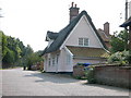
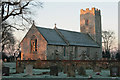
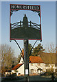
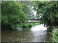
93 photos from this area
Area Information
Key information about the IP20 0EN including its size, population, and administrative classification.
- Area Type
- Postcode
- Area Size
- 28.5 hectares
- Population
- 2547
- Population Density
- 61 people/km²
House Prices in IP20 0EN
35
Properties
£257,278
Average Sold Price
£71,000
Lowest Price
£495,000
Highest Price
Showing 35 properties
| Address | Type | Beds | Baths | Last Sale Price | Last Sale Date | |
|---|---|---|---|---|---|---|
| 125 High Road, Wortwell, IP20 0EN | Detached | 5 | 4 | £467,500 | Dec 2025 | |
| 84 High Road, Wortwell, IP20 0EN | Chalet | 3 | 2 | £315,000 | Jul 2024 | |
| Lakeland Bungalow, 76B High Road, Wortwell, IP20 0EN | Bungalow | 4 | 3 | £408,000 | Dec 2023 | |
| 171 High Road, Wortwell, IP20 0EN | Semi-detached | 2 | 1 | £220,000 | Nov 2020 | |
| 76 High Road, Wortwell, IP20 0EN | house | - | - | £312,500 | Apr 2020 | |
| 100 High Road, Wortwell, IP20 0EN | house | - | - | £150,000 | Feb 2019 | |
| 119 High Road, Wortwell, IP20 0EN | Bungalow | - | - | £495,000 | Feb 2018 | |
| Meadow Cottage, High Road, Wortwell, IP20 0EN | house | - | - | £235,000 | Aug 2017 | |
| 127 High Road, Wortwell, IP20 0EN | Bungalow | 4 | 2 | £350,000 | May 2017 | |
| 90 High Road, Wortwell, IP20 0EN | Bungalow | 3 | - | £260,000 | Mar 2016 |
Page 1 of 4
Energy Efficiency in IP20 0EN
Amenities
Schools
| Rank | School | Type | Entry gender | Ages |
|---|
Explore more schools in this area
Go to Schools tabDemographics
Household Size
Two person
most common
Accommodation Type
Houses
most common
Tenure
77
majority
Ethnic Group
White
most common
Religion
N/A
most common
Household Composition
N/A
most common
Age
47
median
Adults (30-64 years)
most common
Household Deprivation
N/A
with no deprivation
NS-SEC
31
in Lower managerial occupations
Explore more demographic insights in this area
Go to Demographics tabPlanning
Planning Constraints
- Flood RiskPremium
- Ramsar Wetland SitesPremium
- Area of Outstanding Natural BeautyPremium
- Protected Nature ReservePremium
- Protected WoodlandPremium