Area Overview for IP2 9XA
Photos of IP2 9XA


Area Information
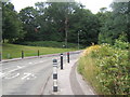
IP2 9XA is a small residential cluster in England with a population of 1198, reflecting a tightly knit community. The area is characterised by its low crime risk, with a safety score of 75, and no significant environmental hazards such as flood zones or protected natural sites. Daily life here is shaped by its proximity to Ipswich, offering easy access to urban amenities while retaining a quiet, residential atmosphere. The area’s modest size means it is likely to have a close-knit social fabric, with residents familiar with one another. With no major industrial or commercial infrastructure nearby, it caters to those seeking a peaceful, low-maintenance lifestyle. The presence of nearby rail connections, including Ipswich Railway Station, ensures connectivity to larger cities, while the area’s broadband score of 100 guarantees reliable internet access. For buyers, IP2 9XA presents a rare blend of safety, simplicity, and practicality, though its small scale means limited housing options.
- Area Type
- Postcode
- Area Size
- Not available
- Population
- 1198
- Population Density
- 6406 people/km²
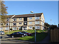
The property market in IP2 9XA is defined by its small size and low home ownership rate of 43%. This suggests a limited number of properties available for sale, with a focus on owner-occupied houses rather than rental properties. The prevalence of houses over flats indicates a more traditional housing stock, which may appeal to buyers seeking family-friendly layouts. However, the area’s modest scale means there is little scope for development or expansion, potentially limiting options for investors or those seeking a wider selection. For buyers, this could mean a slower market with fewer competing properties, but also fewer amenities or services tailored to a growing population. The lack of data on property prices or recent sales means the market remains opaque, though the low crime risk and good broadband connectivity may enhance its appeal.
House Prices in IP2 9XA
No properties found in this postcode.
Energy Efficiency in IP2 9XA
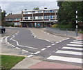
The lifestyle in IP2 9XA is shaped by its proximity to retail and rail amenities. Nearby shops include Tesco Ipswich, Aldi Chantry, and the East of England Co-operative Co, offering essential services for daily living. These stores are within practical reach, reducing the need for long commutes to larger centres. The area’s rail connections, including Ipswich Railway Station, provide access to urban hubs, enabling residents to enjoy cultural or leisure activities in nearby cities. However, the data does not mention parks, restaurants, or other leisure facilities, meaning the area’s lifestyle is likely modest, focused on practicality rather than luxury. The absence of detailed information on recreational options suggests a more utilitarian approach to living here.
Amenities
Schools
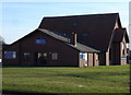
Residents of IP2 9XA have access to three special schools: Belstead School and two instances of The Bridge School. These institutions cater to students with specific educational needs, though no Ofsted ratings are provided in the data. The concentration of special schools suggests the area may be suited to families with children requiring tailored support, but it lacks mainstream primary or secondary schools. This could be a limitation for families seeking a broader range of educational options. The absence of data on school performance or capacity means prospective buyers must investigate further to determine whether the available schools meet their children’s needs.
| Rank | School | Type | Entry gender | Ages |
|---|
Explore more schools in this area
Go to Schools tabDemographics
The population of IP2 9XA is predominantly adults aged 30–64, with a median age of 47. This suggests a community of established professionals and families, rather than students or retirees. Home ownership sits at 43%, which is lower than the national average, indicating a mix of owner-occupied properties and rental units. The area is primarily composed of houses, reflecting a more traditional housing stock compared to flats or apartments. The predominant ethnic group is White, with no data provided on other demographics. The relatively low population—under 1200 residents—means the area is unlikely to have diverse cultural or social hubs. For quality of life, the low crime risk and absence of environmental constraints suggest a stable, if unremarkable, living environment.
Household Size
Accommodation Type
Tenure
Ethnic Group
Religion
Household Composition
Age
Household Deprivation
NS-SEC
Explore more demographic insights in this area
Go to Demographics tabPlanning
Planning Constraints
- Flood RiskPremium
- Ramsar Wetland SitesPremium
- Area of Outstanding Natural BeautyPremium
- Protected Nature ReservePremium
- Protected WoodlandPremium