Area Overview for IP2 9JZ
Photos of IP2 9JZ
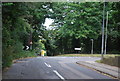
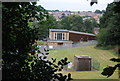
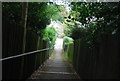
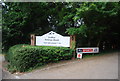
21 photos from this area
Area Information
Key information about the IP2 9JZ including its size, population, and administrative classification.
- Area Type
- Postcode
- Area Size
- 2767 m²
- Population
- 1354
- Population Density
- 5699 people/km²
House Prices in IP2 9JZ
8
Properties
£196,167
Average Sold Price
£165,000
Lowest Price
£265,000
Highest Price
Showing 8 properties
| Address | Type | Beds | Baths | Last Sale Price | Last Sale Date | |
|---|---|---|---|---|---|---|
| 268 Sheldrake Drive, Ipswich, IP2 9JZ | Semi-detached | 3 | 1 | £217,000 | Aug 2025 | |
| 256 Sheldrake Drive, Ipswich, IP2 9JZ | Semi-detached | 3 | 1 | £265,000 | Mar 2024 | |
| 266 Sheldrake Drive, Ipswich, IP2 9JZ | Semi-detached | 3 | 1 | £190,000 | Apr 2021 | |
| 254 Sheldrake Drive, Ipswich, IP2 9JZ | Semi-detached | 3 | 1 | £175,000 | Mar 2016 | |
| 262 Sheldrake Drive, Ipswich, IP2 9JZ | Semi-detached | - | - | £165,000 | Oct 2007 | |
| 264 Sheldrake Drive, Ipswich, IP2 9JZ | Semi-detached | - | - | £165,000 | May 2007 | |
| 260 Sheldrake Drive, Ipswich, IP2 9JZ | Semi-detached | - | - | - | - | |
| 258 Sheldrake Drive, Ipswich, IP2 9JZ | Semi-detached | - | - | - | - |
Energy Efficiency in IP2 9JZ
Amenities
Schools
| Rank | School | Type | Entry gender | Ages |
|---|
Explore more schools in this area
Go to Schools tabDemographics
Household Size
Two person
most common
Accommodation Type
Houses
most common
Tenure
61
majority
Ethnic Group
White
most common
Religion
N/A
most common
Household Composition
N/A
most common
Age
47
median
Adults (30-64 years)
most common
Household Deprivation
N/A
with no deprivation
NS-SEC
24
in Lower managerial occupations
Explore more demographic insights in this area
Go to Demographics tabPlanning
Planning Constraints
- Flood RiskPremium
- Ramsar Wetland SitesPremium
- Area of Outstanding Natural BeautyPremium
- Protected Nature ReservePremium
- Protected WoodlandPremium