Area Overview for IP2 9BN
Photos of IP2 9BN
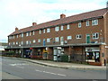
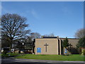
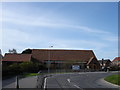
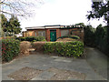

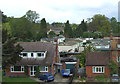
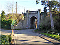
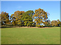
54 photos from this area
Area Information
Key information about the IP2 9BN including its size, population, and administrative classification.
- Area Type
- Postcode
- Area Size
- 6189 m²
- Population
- 1725
- Population Density
- 5047 people/km²
House Prices in IP2 9BN
9
Properties
£160,000
Average Sold Price
£125,500
Lowest Price
£235,000
Highest Price
Showing 9 properties
| Address | Type | Beds | Baths | Last Sale Price | Last Sale Date | |
|---|---|---|---|---|---|---|
| 72 Prince Of Wales Drive, Ipswich, IP2 9BN | Bungalow | - | - | £235,000 | Aug 2021 | |
| 78 Prince Of Wales Drive, Ipswich, IP2 9BN | Bungalow | 2 | 1 | £195,000 | Nov 2018 | |
| 76 Prince Of Wales Drive, Ipswich, IP2 9BN | Bungalow | - | - | £130,000 | Feb 2011 | |
| 74 Prince Of Wales Drive, Ipswich, IP2 9BN | Bungalow | - | - | £149,500 | Mar 2006 | |
| 80 Prince Of Wales Drive, Ipswich, IP2 9BN | Bungalow | 2 | 1 | £140,000 | Dec 2005 | |
| 68 Prince Of Wales Drive, Ipswich, IP2 9BN | Detached | - | - | £145,000 | Feb 2004 | |
| 70 Prince Of Wales Drive, Ipswich, IP2 9BN | Bungalow | 3 | - | £125,500 | Nov 2003 | |
| 66 Prince Of Wales Drive, Ipswich, IP2 9BN | Detached | - | - | - | - | |
| 82 Prince Of Wales Drive, Ipswich, IP2 9BN | Detached | - | - | - | - |
Energy Efficiency in IP2 9BN
Amenities
Schools
| Rank | School | Type | Entry gender | Ages |
|---|
Explore more schools in this area
Go to Schools tabDemographics
Household Size
Two person
most common
Accommodation Type
Houses
most common
Tenure
62
majority
Ethnic Group
White
most common
Religion
N/A
most common
Household Composition
N/A
most common
Age
47
median
Adults (30-64 years)
most common
Household Deprivation
N/A
with no deprivation
NS-SEC
27
in Lower managerial occupations
Explore more demographic insights in this area
Go to Demographics tabPlanning
Planning Constraints
- Flood RiskPremium
- Ramsar Wetland SitesPremium
- Area of Outstanding Natural BeautyPremium
- Protected Nature ReservePremium
- Protected WoodlandPremium