Area Overview for IP2 8PL
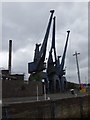
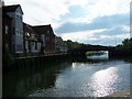
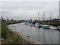
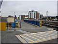
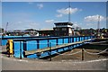
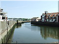
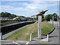
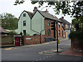
Photos of IP2 8PL


Area Information
Living in IP2 8PL means being part of a tightly knit residential cluster in eastern England, where 1,545 people are spread across just 4.6 hectares. This makes it one of the most densely populated areas in the UK, with 33,935 people per square kilometre. The community is predominantly composed of adults aged 30–64, reflecting a mature demographic profile. Daily life here is shaped by proximity to essential services, with a mix of retail and transport options within walking distance. The area’s compact size means residents are likely to know their neighbours, though the high density may also mean limited private space. Despite its small footprint, IP2 8PL is well-connected to Ipswich via rail links, offering access to city amenities without the need for a car. The presence of two schools and a range of local shops ensures that daily needs are met without long commutes. For those seeking a quiet, established community with practical living conditions, this postcode offers a balance of convenience and residential character.
- Area Type
- Postcode
- Area Size
- 4.6 hectares
- Population
- Not available
- Population Density
- Not available
IP2 8PL is a small, owner-occupied area where 63% of homes are owned by residents. The accommodation type is predominantly houses, which is unusual for a densely populated postcode. This suggests a mix of larger properties and perhaps semi-detached or terraced homes, though the exact layout is not specified. The high home ownership rate indicates a stable market with limited rental activity, making it more attractive to buyers seeking long-term residency. However, the area’s compact size means the housing stock is limited, and buyers may need to consider nearby regions for more options. The presence of houses rather than flats or apartments implies a focus on private, family-oriented living. For those prioritising property investment, the area’s proximity to Ipswich and its rail links could enhance its appeal, though the small size may limit scope for development.
House Prices in IP2 8PL
No properties found in this postcode.
Energy Efficiency in IP2 8PL
Residents of IP2 8PL have access to five retail outlets within practical reach, including Morrisons Daily, East of England Co-operative Co, and Asda Stoke. These shops offer a range of groceries and everyday essentials, reducing the need for long trips to larger centres. The area’s rail connectivity, with five stations including Ipswich Railway Station, provides easy access to the city’s cultural, commercial, and recreational offerings. While the data does not mention parks or leisure facilities, the proximity to Ipswich suggests opportunities for dining, entertainment, and outdoor activities. The compact nature of the area means amenities are closely clustered, fostering a sense of convenience. However, the lack of specific details on green spaces or leisure venues means residents may need to travel slightly further for these activities. The retail and transport options available support a practical, efficient lifestyle.
Amenities
Schools
Residents of IP2 8PL have access to two schools: Stoke High School, a primary school, and Stoke High School – Ormiston Academy, an academy with a ‘good’ Ofsted rating. The presence of both a primary school and an academy offers families a choice of educational settings, from early years to secondary education. The academy’s ‘good’ rating suggests it meets national standards in teaching quality and student outcomes. For parents, this combination of school types may provide flexibility depending on a child’s needs or the family’s preferences. The proximity of these schools to residential properties means commuting is minimal, which is a key consideration for families. However, the data does not indicate whether these schools are oversubscribed or have specific admission criteria, which could affect availability for new residents.
| Rank | School | Type | Entry gender | Ages |
|---|
Explore more schools in this area
Go to Schools tabDemographics
The population of IP2 8PL is 1,545, with a median age of 47 and 63% of residents owning their homes. The area is dominated by adults aged 30–64, indicating a stable, middle-aged community. Home ownership is relatively high, suggesting a mix of long-term residents and those prioritising property investment. The predominant ethnic group is White, though no specific data on diversity or deprivation is provided. The high population density of 33,935 people per square kilometre means living spaces are closely packed, which may influence the character of the neighbourhood. This density also ensures that amenities and services are within easy reach, though it may contribute to a more urbanised feel compared to rural areas. The age profile suggests a community focused on established careers and family life, with fewer young families or elderly residents than average.
Household Size
Accommodation Type
Tenure
Ethnic Group
Religion
Household Composition
Age
Household Deprivation
NS-SEC
Explore more demographic insights in this area
Go to Demographics tabPlanning
Planning Constraints
- Flood RiskPremium
- Ramsar Wetland SitesPremium
- Area of Outstanding Natural BeautyPremium
- Protected Nature ReservePremium
- Protected WoodlandPremium