Area Overview for IP2 8LH
Photos of IP2 8LH
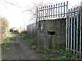
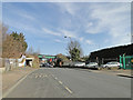
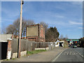
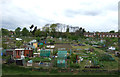
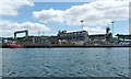
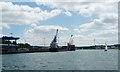

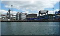
61 photos from this area
Area Information
Key information about the IP2 8LH including its size, population, and administrative classification.
- Area Type
- Postcode
- Area Size
- 1.6 hectares
- Population
- Not available
- Population Density
- Not available
House Prices in IP2 8LH
24
Properties
£122,909
Average Sold Price
£30,000
Lowest Price
£200,000
Highest Price
Showing 24 properties
| Address | Type | Beds | Baths | Last Sale Price | Last Sale Date | |
|---|---|---|---|---|---|---|
| 447 Wherstead Road, Ipswich, IP2 8LH | Detached | 3 | 1 | £138,000 | Oct 2025 | |
| 451 Wherstead Road, Ipswich, IP2 8LH | Semi-detached | 3 | 1 | £192,000 | Mar 2023 | |
| 459 Wherstead Road, Ipswich, IP2 8LH | Semi-detached | 3 | 1 | £200,000 | Mar 2022 | |
| 437 Wherstead Road, Ipswich, IP2 8LH | Terraced | 3 | 2 | £149,000 | Jun 2019 | |
| 433 Wherstead Road, Ipswich, IP2 8LH | Semi-detached | 3 | 1 | £155,000 | Jun 2018 | |
| 467 Wherstead Road, Ipswich, IP2 8LH | Semi-detached | 3 | 1 | £149,100 | Aug 2017 | |
| 429 Wherstead Road, Ipswich, IP2 8LH | house | 3 | 1 | £92,000 | Mar 2014 | |
| 475 Wherstead Road, Ipswich, IP2 8LH | house | 4 | - | £153,000 | Aug 2012 | |
| 463 Wherstead Road, Ipswich, IP2 8LH | house | - | - | £88,500 | Feb 2012 | |
| 473 Wherstead Road, Ipswich, IP2 8LH | Semi-detached | - | - | £155,000 | Nov 2011 |
Page 1 of 3
Energy Efficiency in IP2 8LH
Amenities
Schools
| Rank | School | Type | Entry gender | Ages |
|---|
Explore more schools in this area
Go to Schools tabDemographics
Household Size
Family (3-5 people)
most common
Accommodation Type
Houses
most common
Tenure
63
majority
Ethnic Group
White
most common
Religion
N/A
most common
Household Composition
N/A
most common
Age
47
median
Adults (30-64 years)
most common
Household Deprivation
N/A
with no deprivation
NS-SEC
24
in Lower managerial occupations
Explore more demographic insights in this area
Go to Demographics tabPlanning
Planning Constraints
- Flood RiskPremium
- Ramsar Wetland SitesPremium
- Area of Outstanding Natural BeautyPremium
- Protected Nature ReservePremium
- Protected WoodlandPremium