Area Overview for IP2 0SS
Photos of IP2 0SS
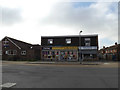

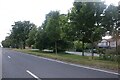
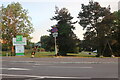
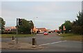
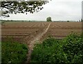
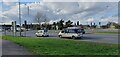
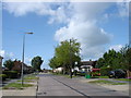
49 photos from this area
Area Information
Key information about the IP2 0SS including its size, population, and administrative classification.
- Area Type
- Postcode
- Area Size
- 51.7 hectares
- Population
- 1207
- Population Density
- 397 people/km²
House Prices in IP2 0SS
12
Properties
£396,944
Average Sold Price
£165,000
Lowest Price
£600,000
Highest Price
Showing 12 properties
| Address | Type | Beds | Baths | Last Sale Price | Last Sale Date | |
|---|---|---|---|---|---|---|
| Omaha House, London Road, Sproughton, IP2 0SS | Detached | - | - | £600,000 | Oct 2023 | |
| The Woodlands, London Road, Sproughton, IP2 0SS | house | - | - | £507,500 | Aug 2019 | |
| Kelmscott, London Road, Sproughton, IP2 0SS | Detached | 3 | 1 | £335,000 | Apr 2018 | |
| Stelvio, London Road, Sproughton, IP2 0SS | house | - | - | £450,000 | Sep 2017 | |
| Martlets, London Road, Sproughton, IP2 0SS | Detached | 4 | 3 | £420,000 | Mar 2017 | |
| Angus Lodge, London Road, Sproughton, IP2 0SS | Chalet | 5 | 4 | £380,000 | Jun 2016 | |
| Long Acre, London Road, Sproughton, IP2 0SS | Detached | 7 | 2 | £465,000 | May 2016 | |
| Holly Lodge, London Road, Sproughton, IP2 0SS | Detached | - | - | £250,000 | Mar 2004 | |
| Little Orchard, London Road, Sproughton, IP2 0SS | Detached | - | - | £165,000 | Jul 1995 | |
| West Ridge, London Road, Sproughton, IP2 0SS | Detached | - | - | - | - |
Page 1 of 2
Energy Efficiency in IP2 0SS
Amenities
Schools
| Rank | School | Type | Entry gender | Ages |
|---|
Explore more schools in this area
Go to Schools tabDemographics
Household Size
Two person
most common
Accommodation Type
Houses
most common
Tenure
82
majority
Ethnic Group
White
most common
Religion
N/A
most common
Household Composition
N/A
most common
Age
47
median
Adults (30-64 years)
most common
Household Deprivation
N/A
with no deprivation
NS-SEC
37
in Lower managerial occupations
Explore more demographic insights in this area
Go to Demographics tabPlanning
Planning Constraints
- Flood RiskPremium
- Ramsar Wetland SitesPremium
- Area of Outstanding Natural BeautyPremium
- Protected Nature ReservePremium
- Protected WoodlandPremium