Area Overview for IP2 0SL
Photos of IP2 0SL


Area Information
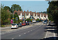
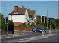
IP2 0SL is a small residential postcode in England, home to 2,513 people living at a density of 2,268 people per square kilometre. This compact area is characterised by its cluster of homes, predominantly flats, which cater to a population skewed towards adults aged 30–64. The community is relatively mature, with a median age of 47, suggesting a stable demographic profile. Daily life here is shaped by proximity to essential services, including retail outlets like Sainsburys in Hadleigh and nearby rail stations such as Ipswich and Westerfield. The area’s small size means residents are likely to know their neighbours, though the high population density may influence the pace of life. While the postcode lacks natural or protected landscapes, it offers practical connectivity to urban amenities. For those prioritising convenience over sprawling green spaces, IP2 0SL provides a compact, service-rich environment. However, potential buyers should note the area’s critical crime risk, which may affect perceptions of safety.
- Area Type
- Postcode
- Area Size
- Not available
- Population
- 2513
- Population Density
- 2268 people/km²
IP2 0SL’s property market is defined by its 44% home ownership rate, indicating that over half of the housing stock is rented. The accommodation type is predominantly flats, which aligns with the area’s compact nature and high population density. This suggests a rental-focused market, with limited availability of larger homes or detached properties. For buyers, this means the area may not suit those seeking family homes or long-term ownership. The prevalence of flats also implies that property values are likely to be influenced by factors such as location within the postcode and proximity to amenities. Given the small size of the area, buyers should consider the immediate surroundings for more housing options. The market’s rental orientation may also mean competition for available properties, particularly among those seeking owner-occupied homes.
House Prices in IP2 0SL
No properties found in this postcode.
Energy Efficiency in IP2 0SL
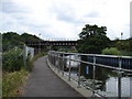
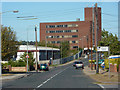
Residents of IP2 0SL have access to a range of nearby amenities, including five retail outlets such as Sainsburys in Hadleigh, Lidl Central, and Iceland in Ipswich. These shops provide everyday essentials, supporting a practical lifestyle. The area’s rail stations—Entrance, Ipswich, and Westerfield—offer straightforward access to regional destinations, enhancing connectivity for both leisure and work. While the data does not mention parks or leisure facilities, the presence of multiple retail and transport options suggests a focus on convenience over expansive recreational spaces. The compact nature of the area means amenities are within practical reach, though those seeking larger green spaces may need to travel further. The combination of retail and rail access creates a lifestyle suited to those valuing ease of access to services and urban mobility.
Amenities
Schools
The nearest school to IP2 0SL is Ranelagh Primary School, which holds a ‘good’ Ofsted rating. This primary school serves the local community, offering education for younger children. The absence of secondary schools in the data means families may need to look beyond the immediate area for secondary education. However, the presence of a well-rated primary school is a positive for parents prioritising early education. The school’s rating suggests it meets acceptable standards in teaching and facilities, though no further details on its size or student numbers are provided. For families with young children, Ranelagh Primary School is a key asset of the area, though secondary schooling would require commuting to nearby towns.
| Rank | School | Type | Entry gender | Ages |
|---|---|---|---|---|
| 1 | Ranelagh Primary School | primary | N/A | N/A |
Explore more schools in this area
Go to Schools tabDemographics
The population of IP2 0SL is dominated by adults aged 30–64, with a median age of 47. This suggests a community of established professionals and families, rather than students or retirees. Home ownership rates stand at 44%, meaning nearly 60% of residents are likely to rent their homes. The predominant accommodation type is flats, reflecting a housing stock suited to smaller households or those prioritising urban living. The predominant ethnic group is White, with no specific data provided on other demographics. The high proportion of adults in this age range implies a mature, possibly low-turnover community. However, the lack of data on deprivation or income levels means it is unclear how this affects access to services or quality of life. The area’s demographics indicate a stable, middle-aged population with established routines and needs, such as proximity to schools and transport.
Household Size
Accommodation Type
Tenure
Ethnic Group
Religion
Household Composition
Age
Household Deprivation
NS-SEC
Explore more demographic insights in this area
Go to Demographics tabPlanning
Planning Constraints
- Flood RiskPremium
- Ramsar Wetland SitesPremium
- Area of Outstanding Natural BeautyPremium
- Protected Nature ReservePremium
- Protected WoodlandPremium
- Crime RiskPremium