Area Overview for IP2 0RX
Photos of IP2 0RX

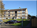
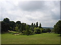
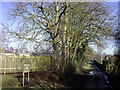
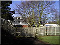
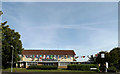
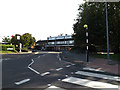
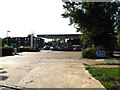
33 photos from this area
Area Information
Key information about the IP2 0RX including its size, population, and administrative classification.
- Area Type
- Postcode
- Area Size
- 1.0 hectares
- Population
- 1460
- Population Density
- 5179 people/km²
House Prices in IP2 0RX
19
Properties
£169,722
Average Sold Price
£75,000
Lowest Price
£220,000
Highest Price
Showing 19 properties
| Address | Type | Beds | Baths | Last Sale Price | Last Sale Date | |
|---|---|---|---|---|---|---|
| 332 Hawthorn Drive, Ipswich, IP2 0RX | Terraced | 3 | 1 | £220,000 | May 2023 | |
| 340 Hawthorn Drive, Ipswich, IP2 0RX | house | - | - | £210,000 | May 2021 | |
| 348 Hawthorn Drive, Ipswich, IP2 0RX | house | - | - | £185,000 | Dec 2020 | |
| 328 Hawthorn Drive, Ipswich, IP2 0RX | Terraced | 3 | - | £210,000 | Oct 2020 | |
| 336 Hawthorn Drive, Ipswich, IP2 0RX | house | 3 | - | £160,000 | Jan 2020 | |
| 346 Hawthorn Drive, Ipswich, IP2 0RX | Terraced | 3 | - | £175,000 | Jul 2017 | |
| 344 Hawthorn Drive, Ipswich, IP2 0RX | Terraced | 3 | 1 | £132,500 | Oct 2014 | |
| 352 Hawthorn Drive, Ipswich, IP2 0RX | Detached | 3 | 1 | £160,000 | Jul 2007 | |
| 322 Hawthorn Drive, Ipswich, IP2 0RX | Semi-detached | - | - | £75,000 | Nov 2001 | |
| 316 Hawthorn Drive, Ipswich, IP2 0RX | house | 3 | - | - | - |
Page 1 of 2
Energy Efficiency in IP2 0RX
Amenities
Schools
| Rank | School | Type | Entry gender | Ages |
|---|
Explore more schools in this area
Go to Schools tabDemographics
Household Size
Family (3-5 people)
most common
Accommodation Type
Houses
most common
Tenure
56
majority
Ethnic Group
White
most common
Religion
N/A
most common
Household Composition
N/A
most common
Age
47
median
Adults (30-64 years)
most common
Household Deprivation
N/A
with no deprivation
NS-SEC
18
in Lower managerial occupations
Explore more demographic insights in this area
Go to Demographics tabPlanning
Planning Constraints
- Flood RiskPremium
- Ramsar Wetland SitesPremium
- Area of Outstanding Natural BeautyPremium
- Protected Nature ReservePremium
- Protected WoodlandPremium