Area Overview for IP2 0JW
Photos of IP2 0JW

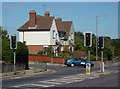
99 photos from this area
Area Information
Key information about the IP2 0JW including its size, population, and administrative classification.
- Area Type
- Postcode
- Area Size
- 1.9 hectares
- Population
- 1658
- Population Density
- 1697 people/km²
House Prices in IP2 0JW
32
Properties
£117,720
Average Sold Price
£49,600
Lowest Price
£255,000
Highest Price
Showing 32 properties
| Address | Type | Beds | Baths | Last Sale Price | Last Sale Date | |
|---|---|---|---|---|---|---|
| 25 Dickens Road, Ipswich, IP2 0JW | Semi-detached | 3 | 1 | £255,000 | Dec 2022 | |
| 21 Dickens Road, Ipswich, IP2 0JW | Detached | 3 | 1 | £122,000 | Jul 2017 | |
| 27 Dickens Road, Ipswich, IP2 0JW | house | - | - | £96,000 | Jun 2010 | |
| 76 Dickens Road, Ipswich, IP2 0JW | house | - | - | £66,000 | Nov 2005 | |
| 46 Dickens Road, Ipswich, IP2 0JW | house | - | - | £49,600 | Jun 2003 | |
| 34B Dickens Road, Ipswich, IP2 0JW | Flat | - | - | - | - | |
| 48 Dickens Road, Ipswich, IP2 0JW | house | - | - | - | - | |
| 50 Dickens Road, Ipswich, IP2 0JW | house | - | - | - | - | |
| 74 Dickens Road, Ipswich, IP2 0JW | house | - | - | - | - | |
| 31 Dickens Road, Ipswich, IP2 0JW | house | - | - | - | - |
Page 1 of 4
Energy Efficiency in IP2 0JW
Amenities
Schools
| Rank | School | Type | Entry gender | Ages |
|---|
Explore more schools in this area
Go to Schools tabDemographics
Household Size
Family (3-5 people)
most common
Accommodation Type
Houses
most common
Tenure
57
majority
Ethnic Group
White
most common
Religion
N/A
most common
Household Composition
N/A
most common
Age
47
median
Adults (30-64 years)
most common
Household Deprivation
N/A
with no deprivation
NS-SEC
20
in Lower managerial occupations
Explore more demographic insights in this area
Go to Demographics tabPlanning
Planning Constraints
- Flood RiskPremium
- Ramsar Wetland SitesPremium
- Area of Outstanding Natural BeautyPremium
- Protected Nature ReservePremium
- Protected WoodlandPremium