Area Overview for IP2 0AD
Photos of IP2 0AD
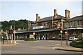
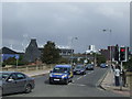
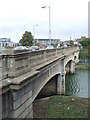
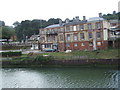
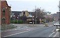
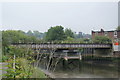
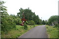
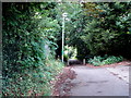
100 photos from this area
Area Information
Key information about the IP2 0AD including its size, population, and administrative classification.
- Area Type
- Postcode
- Area Size
- 1.7 hectares
- Population
- 2513
- Population Density
- 2268 people/km²
House Prices in IP2 0AD
43
Properties
£116,181
Average Sold Price
£29,100
Lowest Price
£220,000
Highest Price
Showing 43 properties
| Address | Type | Beds | Baths | Last Sale Price | Last Sale Date | |
|---|---|---|---|---|---|---|
| 9 Ranelagh Road, Ipswich, IP2 0AD | Terraced | 2 | 1 | £186,000 | Mar 2025 | |
| 75 Ranelagh Road, Ipswich, IP2 0AD | Semi-detached | 3 | 1 | £220,000 | Feb 2024 | |
| 23 Ranelagh Road, Ipswich, IP2 0AD | Terraced | 2 | 1 | £135,000 | Aug 2023 | |
| 49 Ranelagh Road, Ipswich, IP2 0AD | house | - | - | £200,000 | Dec 2022 | |
| 7 Ranelagh Road, Ipswich, IP2 0AD | Terraced | 2 | 1 | £160,000 | Aug 2022 | |
| 79 Ranelagh Road, Ipswich, IP2 0AD | Semi-detached | 2 | 2 | £215,000 | Jan 2022 | |
| 29 Ranelagh Road, Ipswich, IP2 0AD | Terraced | 2 | 1 | £130,000 | Oct 2020 | |
| 51 Ranelagh Road, Ipswich, IP2 0AD | house | - | - | £123,500 | Mar 2020 | |
| 69 Ranelagh Road, Ipswich, IP2 0AD | Semi-detached | 3 | 1 | £171,000 | Feb 2020 | |
| 53 Ranelagh Road, Ipswich, IP2 0AD | house | 3 | - | £100,000 | Feb 2020 |
Page 1 of 5
Energy Efficiency in IP2 0AD
Amenities
Schools
| Rank | School | Type | Entry gender | Ages |
|---|
Explore more schools in this area
Go to Schools tabDemographics
Household Size
One person
most common
Accommodation Type
Flats
most common
Tenure
44
majority
Ethnic Group
White
most common
Religion
N/A
most common
Household Composition
N/A
most common
Age
47
median
Adults (30-64 years)
most common
Household Deprivation
N/A
with no deprivation
NS-SEC
31
in Lower managerial occupations
Explore more demographic insights in this area
Go to Demographics tabPlanning
Planning Constraints
- Flood RiskPremium
- Ramsar Wetland SitesPremium
- Area of Outstanding Natural BeautyPremium
- Protected Nature ReservePremium
- Protected WoodlandPremium