Area Overview for IP19 8JW
Photos of IP19 8JW
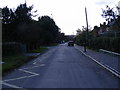
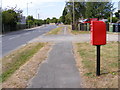
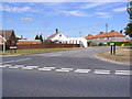
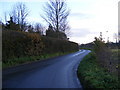
60 photos from this area
Area Information
Key information about the IP19 8JW including its size, population, and administrative classification.
- Area Type
- Postcode
- Area Size
- 2.1 hectares
- Population
- 1517
- Population Density
- 1174 people/km²
House Prices in IP19 8JW
26
Properties
£161,107
Average Sold Price
£55,000
Lowest Price
£320,000
Highest Price
Showing 26 properties
| Address | Type | Beds | Baths | Last Sale Price | Last Sale Date | |
|---|---|---|---|---|---|---|
| 21 Uplands Way, Halesworth, IP19 8JW | Semi-detached | 2 | 1 | £260,000 | Jun 2022 | |
| 13 Uplands Way, Halesworth, IP19 8JW | Semi-detached | 4 | 2 | £320,000 | Jun 2021 | |
| 29 Uplands Way, Halesworth, IP19 8JW | Semi-detached | 2 | 1 | £260,000 | Jan 2021 | |
| 1 Uplands Way, Halesworth, IP19 8JW | Semi-detached | 3 | 1 | £215,000 | Jun 2019 | |
| 5 Uplands Way, Halesworth, IP19 8JW | Semi-detached | 3 | - | £166,500 | Mar 2016 | |
| 23 Uplands Way, Halesworth, IP19 8JW | Semi-detached | 2 | - | £160,000 | Feb 2015 | |
| 27 Uplands Way, Halesworth, IP19 8JW | Bungalow | 3 | - | £138,000 | Aug 2011 | |
| 35 Uplands Way, Halesworth, IP19 8JW | Bungalow | - | - | £134,600 | Jun 2009 | |
| 6 Uplands Way, Halesworth, IP19 8JW | Semi-detached | - | - | £83,000 | Oct 2006 | |
| 19 Uplands Way, Halesworth, IP19 8JW | Semi-detached | 3 | 2 | £142,500 | Jul 2004 |
Page 1 of 3
Energy Efficiency in IP19 8JW
Amenities
Schools
| Rank | School | Type | Entry gender | Ages |
|---|
Explore more schools in this area
Go to Schools tabDemographics
Household Size
Two person
most common
Accommodation Type
Houses
most common
Tenure
70
majority
Ethnic Group
White
most common
Religion
N/A
most common
Household Composition
N/A
most common
Age
47
median
Adults (30-64 years)
most common
Household Deprivation
N/A
with no deprivation
NS-SEC
27
in Lower managerial occupations
Explore more demographic insights in this area
Go to Demographics tabPlanning
Planning Constraints
- Flood RiskPremium
- Ramsar Wetland SitesPremium
- Area of Outstanding Natural BeautyPremium
- Protected Nature ReservePremium
- Protected WoodlandPremium