Area Overview for IP19 0DH
Photos of IP19 0DH
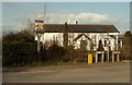
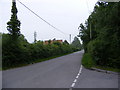

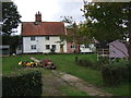
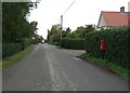
29 photos from this area
Area Information
Key information about the IP19 0DH including its size, population, and administrative classification.
- Area Type
- Postcode
- Area Size
- 16.1 hectares
- Population
- 2142
- Population Density
- 27 people/km²
House Prices in IP19 0DH
12
Properties
£330,219
Average Sold Price
£21,000
Lowest Price
£810,000
Highest Price
Showing 12 properties
| Address | Type | Beds | Baths | Last Sale Price | Last Sale Date | |
|---|---|---|---|---|---|---|
| Old Post Office Cottage, Bell Green, Cratfield, IP19 0DH | house | 4 | 1 | £400,000 | Dec 2023 | |
| Potters Roost, Bell Green, Cratfield, IP19 0DH | Detached | 4 | 2 | £810,000 | Sep 2021 | |
| Foxglove House, Bell Green, Cratfield, IP19 0DH | Detached | 4 | 3 | £360,000 | Mar 2019 | |
| Stokes Cottage, Bell Green, Cratfield, IP19 0DH | house | - | - | £231,250 | Mar 2017 | |
| Bellfields, Bell Green, Cratfield, IP19 0DH | Bungalow | 4 | - | £285,000 | Sep 2015 | |
| Monk Frith, Bell Green, Cratfield, IP19 0DH | Detached | 4 | 2 | £242,500 | Jan 2009 | |
| Blackthorn Cottage, Bell Green, Cratfield, IP19 0DH | Semi-detached | - | - | £292,000 | Jul 2007 | |
| Tanglewood, Bell Green, Cratfield, IP19 0DH | Detached | 4 | 2 | £21,000 | Jun 1998 | |
| Allambee, Bell Green, Cratfield, IP19 0DH | Detached | - | - | - | - | |
| Ashlea, Bell Green, Cratfield, IP19 0DH | Detached | - | - | - | - |
Page 1 of 2
Energy Efficiency in IP19 0DH
Amenities
Schools
| Rank | School | Type | Entry gender | Ages |
|---|
Explore more schools in this area
Go to Schools tabDemographics
Household Size
Two person
most common
Accommodation Type
Houses
most common
Tenure
75
majority
Ethnic Group
White
most common
Religion
N/A
most common
Household Composition
N/A
most common
Age
47
median
Adults (30-64 years)
most common
Household Deprivation
N/A
with no deprivation
NS-SEC
35
in Lower managerial occupations
Explore more demographic insights in this area
Go to Demographics tabPlanning
Planning Constraints
- Flood RiskPremium
- Ramsar Wetland SitesPremium
- Area of Outstanding Natural BeautyPremium
- Protected Nature ReservePremium
- Protected WoodlandPremium