Area Overview for IP18 6TS
Photos of IP18 6TS
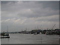
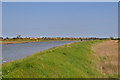
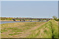
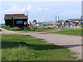
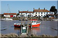

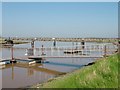
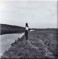
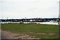
98 photos from this area
Area Information
Key information about the IP18 6TS including its size, population, and administrative classification.
- Area Type
- Postcode
- Area Size
- 10.0 hectares
- Population
- 2019
- Population Density
- 41 people/km²
House Prices in IP18 6TS
11
Properties
£839,700
Average Sold Price
£443,500
Lowest Price
£1,400,000
Highest Price
Showing 11 properties
| Address | Type | Beds | Baths | Last Sale Price | Last Sale Date | |
|---|---|---|---|---|---|---|
| Corner Cottage, Leveretts Lane, Walberswick, IP18 6TS | house | - | - | £855,000 | Mar 2023 | |
| Marshway, Leveretts Lane, Walberswick, IP18 6TS | house | - | - | £1,400,000 | Oct 2020 | |
| Northfields Hall, Leveretts Lane, Walberswick, IP18 6TS | Detached | 4 | 2 | £875,000 | Aug 2015 | |
| Webster Cottage, Leveretts Lane, Walberswick, IP18 6TS | house | - | - | £443,500 | Jan 2011 | |
| Cornelian, Leveretts Lane, Walberswick, IP18 6TS | house | - | - | £625,000 | Mar 2008 | |
| Walber House, Leveretts Lane, Walberswick, IP18 6TS | Detached | 7 | 3 | - | - | |
| Innisfree, Leveretts Lane, Walberswick, IP18 6TS | undefined | - | - | - | - | |
| The Old School, Leveretts Lane, Walberswick, IP18 6TS | Detached | - | - | - | - | |
| Saltlick, Leveretts Lane, Walberswick, IP18 6TS | house | - | - | - | - | |
| Quietways, Leveretts Lane, Walberswick, IP18 6TS | Detached | - | - | - | - |
Page 1 of 2
Energy Efficiency in IP18 6TS
Amenities
Schools
| Rank | School | Type | Entry gender | Ages |
|---|
Explore more schools in this area
Go to Schools tabDemographics
Household Size
Two person
most common
Accommodation Type
Houses
most common
Tenure
76
majority
Ethnic Group
White
most common
Religion
N/A
most common
Household Composition
N/A
most common
Age
47
median
Adults (30-64 years)
most common
Household Deprivation
N/A
with no deprivation
NS-SEC
39
in Lower managerial occupations
Explore more demographic insights in this area
Go to Demographics tabPlanning
Planning Constraints
- Flood RiskPremium
- Ramsar Wetland SitesPremium
- Area of Outstanding Natural BeautyPremium
- Protected Nature ReservePremium
- Protected WoodlandPremium