Area Overview for IP17 2LW
Photos of IP17 2LW
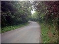
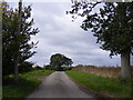
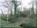
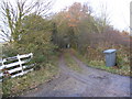
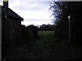
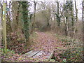
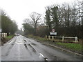
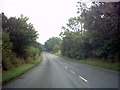
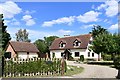


19 photos from this area
Area Information
Key information about the IP17 2LW including its size, population, and administrative classification.
- Area Type
- Postcode
- Area Size
- 1.1 km²
- Population
- 2142
- Population Density
- 27 people/km²
House Prices in IP17 2LW
36
Properties
£425,000
Average Sold Price
£215,000
Lowest Price
£690,000
Highest Price
Showing 36 properties
| Address | Type | Beds | Baths | Last Sale Price | Last Sale Date | |
|---|---|---|---|---|---|---|
| The Willow, Mill Road, Peasenhall, IP17 2LW | house | 4 | 2 | £595,000 | Jul 2025 | |
| 1, Plumbers Yard, Mill Road, Peasenhall, IP17 2LW | Detached | 4 | 2 | £460,000 | Dec 2022 | |
| Viewlands, Mill Road, Peasenhall, IP17 2LW | Bungalow | - | - | £690,000 | Aug 2022 | |
| The Shieling, Mill Road, Peasenhall, IP17 2LW | house | - | - | £466,000 | Apr 2022 | |
| 3, Plumbers Yard, Mill Road, Peasenhall, IP17 2LW | Bungalow | 3 | 2 | £460,000 | Sep 2021 | |
| 2, Plumbers Yard, Mill Road, Peasenhall, IP17 2LW | Detached | 3 | 2 | £360,000 | Sep 2021 | |
| Byways, Mill Road, Peasenhall, IP17 2LW | Detached | 3 | 2 | £525,000 | Nov 2017 | |
| Millstone Cottage, Mill Road, Peasenhall, IP17 2LW | Detached | 3 | 2 | £395,000 | Nov 2015 | |
| The Lictors, Mill Road, Peasenhall, IP17 2LW | house | 4 | - | £385,000 | Dec 2012 | |
| Overdale, Mill Road, Peasenhall, IP17 2LW | Detached | - | - | £380,000 | Jun 2009 |
Page 1 of 4
Energy Efficiency in IP17 2LW
Amenities
Schools
| Rank | School | Type | Entry gender | Ages |
|---|
Explore more schools in this area
Go to Schools tabDemographics
Household Size
Two person
most common
Accommodation Type
Houses
most common
Tenure
75
majority
Ethnic Group
White
most common
Religion
N/A
most common
Household Composition
N/A
most common
Age
47
median
Adults (30-64 years)
most common
Household Deprivation
N/A
with no deprivation
NS-SEC
35
in Lower managerial occupations
Explore more demographic insights in this area
Go to Demographics tabPlanning
Planning Constraints
- Flood RiskPremium
- Ramsar Wetland SitesPremium
- Area of Outstanding Natural BeautyPremium
- Protected Nature ReservePremium
- Protected WoodlandPremium