Area Overview for IP17 2LE
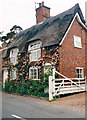
Photos of IP17 2LE


Area Information
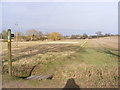
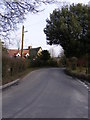
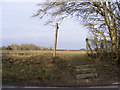
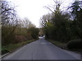
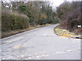
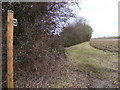
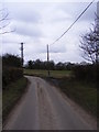
Living in IP17 2LE offers a quiet, low-density lifestyle in a small residential cluster in England. With a population of 2,142 spread across 27 people per square kilometre, the area feels unspoiled and community-focused. It is a place where traditional housing dominates, with 75% of residents owning their homes. The median age of 47 suggests a settled population, with adults aged 30–64 forming the majority. Daily life here is likely characterised by a slower pace, with local amenities and transport links providing practical convenience. The area’s small size means it is not densely built, offering space without sacrificing proximity to essential services. For those seeking a balance between rural tranquillity and accessible infrastructure, IP17 2LE presents a compelling case. Its proximity to rail stations and nearby retail hubs ensures connectivity, while the absence of environmental constraints like protected woodlands or AONB designations makes it a straightforward place to live. This is a community where stability and simplicity are prioritised, appealing to those who value a predictable, low-risk environment.
- Area Type
- Postcode
- Area Size
- Not available
- Population
- 2142
- Population Density
- 27 people/km²
The property market in IP17 2LE is dominated by owner-occupied homes, with 75% of residents living in properties they own. This high rate of home ownership suggests a stable, long-term market with fewer rental properties. The accommodation type is primarily houses, which is typical for a low-density area. This means the housing stock is likely characterised by single-family homes, offering space and privacy. For buyers, this presents an opportunity to purchase in a market where properties are likely to remain in private hands rather than being subject to frequent rental turnover. The small size of the area means the housing stock is limited, but the focus on owner-occupation implies a strong local demand. Buyers should consider that the market may be more competitive for traditional homes, with fewer modern or specialist property types available. The absence of planning constraints or environmental designations also makes it a straightforward area for development or purchase.
House Prices in IP17 2LE
No properties found in this postcode.
Energy Efficiency in IP17 2LE
The lifestyle in IP17 2LE is shaped by its proximity to practical amenities. Nearby retail options include Budgens Darsham, Waitrose Saxmundham, and Co-op Laxfield, offering a range of shopping and grocery needs. These stores provide convenience for daily errands, reducing the need for long trips to larger towns. The area’s rail stations, such as Darsham and Saxmundham, add to its accessibility, allowing residents to travel easily for work, leisure, or socialising. While the data does not mention parks or leisure facilities, the low population density suggests potential for open spaces or community areas. The combination of local retail and rail links creates a self-contained environment, ideal for those who prefer a balance between independence and connectivity. The area’s character is defined by its practicality, with amenities designed to meet the needs of a small, stable community.
Amenities
Schools
Residents of IP17 2LE have access to two primary schools: Peasenhall Primary School and Cookley and Walpole Church of England Voluntary Controlled Primary School. Both institutions cater to younger children, providing essential education for families in the area. The presence of two primary schools within practical reach suggests a focus on early education, though no secondary schools are listed in the data. For families with young children, this offers convenience, reducing the need for long commutes to schooling. The mix of school types—both state and church-controlled—provides options for different educational preferences. However, the absence of secondary school data means parents may need to look further afield for secondary education. This is a key consideration for families planning long-term in the area, as the current school infrastructure is limited to primary levels.
| Rank | School | Type | Entry gender | Ages |
|---|
Explore more schools in this area
Go to Schools tabDemographics
The community in IP17 2LE is predominantly composed of adults aged 30–64, with a median age of 47. This suggests a mature, established population, likely with long-term ties to the area. Home ownership is high at 75%, indicating a strong sense of local investment and stability. The accommodation type is primarily houses, which aligns with the area’s low-density character. The predominant ethnic group is White, reflecting a homogenous demographic profile. While this data does not include specific information on deprivation or diversity beyond ethnicity, the high home ownership rate and age distribution suggest a community with relatively stable economic conditions. The absence of younger or older demographics may mean fewer family-oriented or retirement-focused services, though this is not explicitly stated in the data. Overall, the area appears to cater to middle-aged residents seeking a settled, low-maintenance lifestyle.
Household Size
Accommodation Type
Tenure
Ethnic Group
Religion
Household Composition
Age
Household Deprivation
NS-SEC
Explore more demographic insights in this area
Go to Demographics tabPlanning
Planning Constraints
- Flood RiskPremium
- Ramsar Wetland SitesPremium
- Area of Outstanding Natural BeautyPremium
- Protected Nature ReservePremium
- Protected WoodlandPremium