Area Overview for IP17 2AQ
Photos of IP17 2AQ
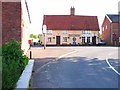
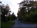
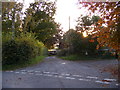
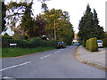


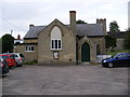
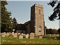
82 photos from this area
Area Information
Key information about the IP17 2AQ including its size, population, and administrative classification.
- Area Type
- Postcode
- Area Size
- 2.9 hectares
- Population
- 2073
- Population Density
- 37 people/km²
House Prices in IP17 2AQ
8
Properties
£455,500
Average Sold Price
£241,000
Lowest Price
£635,000
Highest Price
Showing 8 properties
| Address | Type | Beds | Baths | Last Sale Price | Last Sale Date | |
|---|---|---|---|---|---|---|
| Sequoia House, Bruisyard Road, Rendham, IP17 2AQ | Detached | 5 | 2 | £635,000 | Nov 2025 | |
| The Brambles, Bruisyard Road, Rendham, IP17 2AQ | Detached | 4 | 3 | £575,000 | Feb 2018 | |
| Half Acre, Bruisyard Road, Rendham, IP17 2AQ | Detached | 4 | - | £430,000 | Oct 2014 | |
| East Homewood, Bruisyard Road, Rendham, IP17 2AQ | house | - | - | £429,000 | Mar 2014 | |
| Christmas Cottage, Bruisyard Road, Rendham, IP17 2AQ | Detached | - | - | £423,000 | Sep 2009 | |
| Butterfly Cottage, Bruisyard Road, Rendham, IP17 2AQ | Detached | - | - | £241,000 | Jul 2002 | |
| The Old Manse, Bruisyard Road, Rendham, IP17 2AQ | Detached | - | - | - | - | |
| Home Meadow, Bruisyard Road, Rendham, IP17 2AQ | Detached | - | - | - | - |
Energy Efficiency in IP17 2AQ
Amenities
Schools
| Rank | School | Type | Entry gender | Ages |
|---|
Explore more schools in this area
Go to Schools tabDemographics
Household Size
Two person
most common
Accommodation Type
Houses
most common
Tenure
70
majority
Ethnic Group
White
most common
Religion
N/A
most common
Household Composition
N/A
most common
Age
47
median
Adults (30-64 years)
most common
Household Deprivation
N/A
with no deprivation
NS-SEC
40
in Lower managerial occupations
Explore more demographic insights in this area
Go to Demographics tabPlanning
Planning Constraints
- Flood RiskPremium
- Ramsar Wetland SitesPremium
- Area of Outstanding Natural BeautyPremium
- Protected Nature ReservePremium
- Protected WoodlandPremium