Area Overview for IP17 1HN
Photos of IP17 1HN
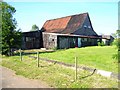
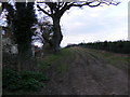
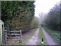
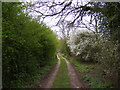
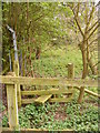
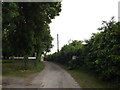
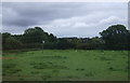

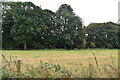
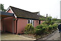
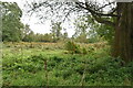
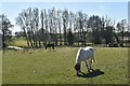
39 photos from this area
Area Information
Key information about the IP17 1HN including its size, population, and administrative classification.
- Area Type
- Postcode
- Area Size
- 38.7 hectares
- Population
- 1984
- Population Density
- 51 people/km²
House Prices in IP17 1HN
22
Properties
£392,654
Average Sold Price
£150,000
Lowest Price
£1,109,407
Highest Price
Showing 22 properties
| Address | Type | Beds | Baths | Last Sale Price | Last Sale Date | |
|---|---|---|---|---|---|---|
| Honey Pot Lodge, Aldecar Lane, Benhall, IP17 1HN | Detached | 4 | - | £1,109,407 | Aug 2022 | |
| 1, Brookfields, Aldecar Lane, Benhall, IP17 1HN | house | - | - | £247,500 | Nov 2021 | |
| 2, Brookfields, Aldecar Lane, Benhall, IP17 1HN | house | - | - | £247,500 | Sep 2021 | |
| 3, Brookfields, Aldecar Lane, Benhall, IP17 1HN | house | - | - | £247,500 | Sep 2021 | |
| 4, Brookfields, Aldecar Lane, Benhall, IP17 1HN | house | - | - | £248,100 | Sep 2021 | |
| 28 Aldecar Lane, Benhall, IP17 1HN | Land | - | - | £372,500 | Mar 2021 | |
| Pearcroft, Aldecar Lane, Benhall, IP17 1HN | Semi-detached | 3 | - | £745,000 | Feb 2020 | |
| Boodles, Aldecar Lane, Benhall, IP17 1HN | Detached | 4 | 3 | £475,000 | Jan 2019 | |
| The Old Flint Barn, Aldecar Lane, Benhall, IP17 1HN | house | - | - | £452,000 | Aug 2014 | |
| Trevelyan Cottage, Aldecar Lane, Benhall, IP17 1HN | Detached | 2 | 1 | £265,000 | Jul 2014 |
Page 1 of 3
Energy Efficiency in IP17 1HN
Amenities
Schools
| Rank | School | Type | Entry gender | Ages |
|---|
Explore more schools in this area
Go to Schools tabDemographics
Household Size
Two person
most common
Accommodation Type
Houses
most common
Tenure
78
majority
Ethnic Group
White
most common
Religion
N/A
most common
Household Composition
N/A
most common
Age
47
median
Adults (30-64 years)
most common
Household Deprivation
N/A
with no deprivation
NS-SEC
39
in Lower managerial occupations
Explore more demographic insights in this area
Go to Demographics tabPlanning
Planning Constraints
- Flood RiskPremium
- Ramsar Wetland SitesPremium
- Area of Outstanding Natural BeautyPremium
- Protected Nature ReservePremium
- Protected WoodlandPremium