Area Overview for IP16 4HY
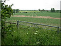
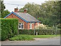
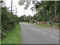
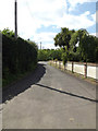
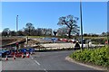
Photos of IP16 4HY


Area Information
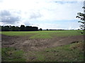
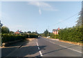
Living in IP16 4HY offers a compact, well-defined residential experience in a small cluster of homes. The area covers 3.3 hectares, housing 1,599 residents at a density of 674 people per square kilometre. This is a mature community, with a median age of 47 and a majority of residents aged 30–64. Daily life is shaped by proximity to essential services, including four railway stations and five retail outlets such as Waitrose Saxmundham and Tesco Saxmundham. The area’s safety is notable, with a crime risk score of 71, indicating below-average crime rates. Families are well-served by a mix of primary, independent, and special schools, while digital connectivity scores of 87 for broadband and 79 for mobile coverage support both work and leisure. IP16 4HY is ideal for those seeking a balanced, low-risk environment with practical access to amenities and transport links, though its small size means the housing market is limited to a specific cluster of properties.
- Area Type
- Postcode
- Area Size
- 3.3 hectares
- Population
- 1599
- Population Density
- 674 people/km²
The property market in IP16 4HY is characterised by a 58% home ownership rate, with houses forming the majority of the housing stock. This suggests a community where long-term residency is common, and the area is not heavily reliant on rental properties. Given the small size of the postcode—just 3.3 hectares—the housing stock is limited, making it a niche market for buyers seeking specific properties. The focus on houses rather than flats implies a preference for family homes, which aligns with the age profile of residents (predominantly 30–64 years). For buyers, this means competition may be higher for available properties, and proximity to amenities such as schools and transport links is a key consideration. The area’s compact nature means that property values are likely influenced by proximity to Saxmundham’s retail and rail networks, which are within practical reach.
House Prices in IP16 4HY
No properties found in this postcode.
Energy Efficiency in IP16 4HY
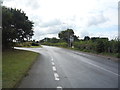
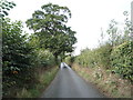
The lifestyle in IP16 4HY is defined by its proximity to retail, dining, and transport hubs. Within practical reach are five retail outlets, including the East of England Co-operative Co, Waitrose Saxmundham, and Tesco Saxmundham, offering a range of shopping options. The four railway stations, including Saxmundham Railway Station, provide access to regional travel, making it easier to explore nearby towns or commute to larger cities. While the area’s small size means green spaces are limited, the presence of nearby schools and amenities suggests a community-focused environment. The combination of retail convenience, reliable transport, and low crime rates contributes to a practical, low-stress lifestyle. Residents benefit from the balance between local services and the ability to travel further afield, though those prioritising extensive leisure or outdoor activities may need to look beyond the immediate postcode.
Amenities
Schools
Residents of IP16 4HY have access to a range of educational institutions, including Leiston Middle School, a primary school, and Summerhill School, an independent school with a good Ofsted rating. Compass Community School Aylward Park, a special school also rated good by Ofsted, provides tailored support for specific needs. This mix of school types offers families flexibility, whether they seek state education, independent schooling, or specialist provision. The presence of a special school indicates the area’s capacity to accommodate diverse educational requirements, while the independent school caters to those prioritising alternative curricula. However, the absence of secondary schools within the postcode means families may need to consider commuting to nearby towns for older children. The quality ratings of the schools suggest a generally reliable educational environment, though proximity to secondary education remains a practical consideration for growing families.
| Rank | School | Type | Entry gender | Ages |
|---|
Explore more schools in this area
Go to Schools tabDemographics
The community in IP16 4HY is predominantly composed of adults aged 30–64, with a median age of 47. Home ownership rates stand at 58%, and the majority of properties are houses rather than flats. The predominant ethnic group is White, reflecting a homogenous demographic profile. This age group suggests a stable, established population, likely with strong family ties and long-term residency. The absence of specific deprivation data means the area’s quality of life is inferred from its safety metrics and access to services. With no mention of socioeconomic challenges in the data, the focus remains on the practical aspects of living here, such as the availability of schools and transport. The demographic structure indicates a community that prioritises stability, with fewer transient residents compared to areas with higher rental occupancy rates.
Household Size
Accommodation Type
Tenure
Ethnic Group
Religion
Household Composition
Age
Household Deprivation
NS-SEC
Explore more demographic insights in this area
Go to Demographics tabPlanning
Planning Constraints
- Flood RiskPremium
- Ramsar Wetland SitesPremium
- Area of Outstanding Natural BeautyPremium
- Protected Nature ReservePremium
- Protected WoodlandPremium