Area Overview for IP14 4WG
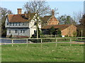
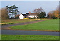
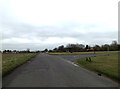
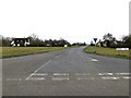
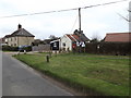
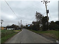
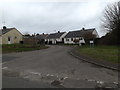
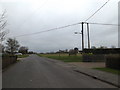
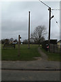
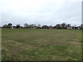
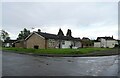
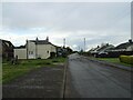
Photos of IP14 4WG
Area Information
Living in IP14 4WG means being part of a small, tightly knit residential cluster in England. With a population of 2,585 and a density of 171 people per square kilometre, this area balances compactness with a sense of community. The median age of 47 suggests a mature demographic, with adults aged 30–64 forming the largest group. Daily life here is shaped by its rural character, with homes predominantly owner-occupied at 74%, reflecting a stable, long-term resident base. The area’s proximity to Stowmarket and nearby towns offers easy access to services without the pressure of urban density. Residents benefit from a mix of local amenities, including shops, rail links, and schools, while the surrounding landscape remains largely free of environmental constraints. This postcode is ideal for those seeking a quieter lifestyle, with a focus on family-friendly infrastructure and reliable connectivity. The low crime risk and absence of flood or planning restrictions further enhance its appeal for buyers looking for a secure, low-maintenance environment.
- Area Type
- Postcode
- Area Size
- Not available
- Population
- 2585
- Population Density
- 171 people/km²
The property market in IP14 4WG is characterised by a high rate of home ownership, with 74% of properties owner-occupied. This suggests a stable market where long-term residents are more likely to retain their homes, reducing turnover and competition for buyers. The accommodation type is predominantly houses, which are typically larger and more private than flats, appealing to families or individuals seeking space. This focus on owner-occupied housing implies limited availability of rental properties, making the area less attractive to investors or those prioritising flexibility. The small postcode area means buyers should consider nearby suburbs or towns for additional options, though the immediate vicinity offers a cohesive, low-density environment. The absence of planning constraints or environmental restrictions further supports the appeal of purchasing here, as properties are unlikely to face legal or regulatory hurdles.
House Prices in IP14 4WG
No properties found in this postcode.
Energy Efficiency in IP14 4WG
Residents of IP14 4WG enjoy a range of nearby amenities that support daily life. The area is within reach of five retail outlets, including Co-op Petrol, Tesco Stowmarket, and Lidl Cedars, offering grocery and convenience shopping. Rail services are accessible via stations such as Entrance1, Stowmarket, and Needham Market, providing links to regional hubs. The proximity to RAF Wattisham adds a unique element to the local landscape, though it does not detract from the availability of everyday services. The combination of shops, transport links, and a low-density environment creates a lifestyle that balances convenience with a sense of tranquillity. For those who prefer to stay local, the area’s amenities are sufficient for routine needs, while the rail network ensures easy access to more extensive facilities in nearby towns.
Amenities
Schools
Residents of IP14 4WG have access to a range of educational institutions, including Freeman Community Primary School and Stowupland High School. Freeman Community Primary School, which holds a 'good' Ofsted rating, provides early education for younger children, while Stowupland High School offers both primary and academy-level education. The presence of two schools under the same name suggests a possible merger or dual provision, though the exact relationship between them is not specified. The mix of primary and academy schools offers families flexibility, with academies often providing specialist curricula or governance structures. This diversity ensures that parents can choose between traditional state schools and academies, depending on their priorities. The proximity of these schools to the area reinforces its appeal for families seeking reliable, locally based education without long commutes.
| Rank | School | Type | Entry gender | Ages |
|---|---|---|---|---|
| 1 | Freeman Community Primary School | primary | N/A | N/A |
| 2 | Stowupland High School | primary | N/A | N/A |
| 3 | Stowupland High School | academy | N/A | N/A |
| 4 | Freeman Community Primary School | primary | N/A | N/A |
| 5 | Stowupland High School | academy | N/A | N/A |
Explore more schools in this area
Go to Schools tabDemographics
The community in IP14 4WG is predominantly composed of adults aged 30–64, with a median age of 47. This suggests a population that is largely established, with fewer young families or retirees compared to other areas. Home ownership is high, at 74%, indicating a strong presence of long-term residents and a stable housing market. The majority of properties are houses, which aligns with the area’s residential character and likely contributes to a quieter, more private living experience. The predominant ethnic group is White, though specific data on diversity or deprivation is not provided. The absence of significant demographic diversity means the community’s cultural composition is relatively homogeneous. With no data on income levels or deprivation, it is difficult to assess socioeconomic variation, but the high home ownership rate and low crime risk suggest a generally stable and secure environment for residents.
Household Size
Accommodation Type
Tenure
Ethnic Group
Religion
Household Composition
Age
Household Deprivation
NS-SEC
Explore more demographic insights in this area
Go to Demographics tabPlanning
Planning Constraints
- Flood RiskPremium
- Ramsar Wetland SitesPremium
- Area of Outstanding Natural BeautyPremium
- Protected Nature ReservePremium
- Protected WoodlandPremium
- Crime RiskPremium