Area Overview for IP14 3SB
Photos of IP14 3SB
Area Information
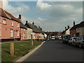
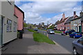
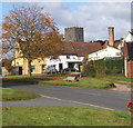
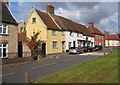
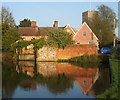
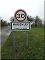
Living in IP14 3SB means being part of a small, tightly knit residential cluster in England. With a population of 2199 spread across 118 people per square kilometre, this area offers a quiet, low-density lifestyle. The community is characterised by its mature demographic, with a median age of 47 and a strong presence of adults aged 30–64. Most homes are owner-occupied, reflecting a stable, long-term resident base. Daily life here is defined by proximity to local amenities, with retail options and rail links within easy reach. The area’s compact size fosters a sense of familiarity, while its low crime risk and lack of environmental constraints make it appealing for families and retirees alike. Though modest in scale, IP14 3SB combines practicality with a relaxed pace, ideal for those prioritising safety, community connection, and ease of access to nearby services.
- Area Type
- Postcode
- Area Size
- Not available
- Population
- 2199
- Population Density
- 118 people/km²
The property market in IP14 3SB is largely defined by owner-occupation, with 73% of homes owned by their residents. This high rate of home ownership suggests a stable market with limited rental activity, making it less of a transient area. The accommodation type is predominantly houses, which aligns with the demographic profile of older, established residents. In such a small area, the housing stock is likely to be characterised by traditional, family-friendly properties rather than modern developments. For buyers, this means a focus on homes with long-term value and potential for personalisation. However, the limited scale of the area may restrict availability, requiring buyers to consider nearby regions for more options. The absence of planning constraints or environmental risks further supports the appeal of IP14 3SB as a secure, low-maintenance place to live.
House Prices in IP14 3SB
No properties found in this postcode.
Energy Efficiency in IP14 3SB
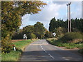
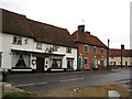
Residents of IP14 3SB have access to essential retail services, including East of England Co-operative Co, Spar, and Budgens Chilton, all within practical reach. These local shops provide convenience for everyday needs, reducing the necessity for long trips to larger centres. The nearby rail stations, such as Elmswell and Entrance, offer easy access to broader regional networks, supporting both commuting and leisure travel. While the area lacks expansive parks or leisure facilities, its proximity to rail and retail ensures a balanced lifestyle. The combination of local amenities and transport links makes daily life efficient, with a focus on practicality over large-scale recreation.
Amenities
Schools
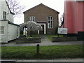
Residents of IP14 3SB have access to a mix of state and independent schooling. Crawford’s Church of England Voluntary Controlled Primary School and Crawford’s Church of England Primary School are both state-funded primary institutions, with the latter holding a ‘good’ Ofsted rating. For independent education, Hillcroft Preparatory School offers an alternative, though it is not rated in the data. The presence of two primary schools provides families with choices, while the absence of secondary schools may necessitate travel to nearby towns. This mix of school types caters to diverse educational preferences, though parents should consider the need for additional transport arrangements for older children.
| Rank | School | Type | Entry gender | Ages |
|---|---|---|---|---|
| 1 | Crawford's Church of England Voluntary Controlled Primary School | primary | N/A | N/A |
| 2 | Hillcroft Preparatory School | independent | N/A | N/A |
| 3 | Crawford's Church of England Primary School | primary | N/A | N/A |
Explore more schools in this area
Go to Schools tabDemographics
IP14 3SB has a median age of 47, with the majority of residents falling within the 30–64 age range. This suggests a community skewed towards middle-aged and older adults, likely including retirees and long-term homeowners. Home ownership is high at 73%, indicating a stable, settled population. The area is predominantly composed of houses rather than flats, aligning with the preferences of older demographics. The predominant ethnic group is White, though specific data on diversity or deprivation is not provided. The population density of 118 people per square kilometre implies a low-rise, spread-out settlement pattern. For buyers, this profile suggests a neighbourhood where property values are likely to hold steady, and the character of the area is shaped by its mature, owner-occupied residents.
Household Size
Accommodation Type
Tenure
Ethnic Group
Religion
Household Composition
Age
Household Deprivation
NS-SEC
Explore more demographic insights in this area
Go to Demographics tabPlanning
Planning Constraints
- Flood RiskPremium
- Ramsar Wetland SitesPremium
- Area of Outstanding Natural BeautyPremium
- Protected Nature ReservePremium
- Protected WoodlandPremium
- Crime RiskPremium