Area Overview for IP14 2AG
Photos of IP14 2AG
Area Information
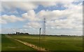
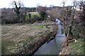
IP14 2AG is a small, compact residential area in England, covering just 19.3 hectares and home to 1,600 residents. Its high population density of 1,344 people per square kilometre reflects a tightly knit community, where daily life is shaped by proximity to local amenities and schools. The area’s character is defined by its modest size and the mix of housing types, with a focus on owner-occupied homes. Residents here are predominantly adults aged 30–64, many of whom have lived in the area for years. Living in IP14 2AG means access to nearby schools, retail outlets, and rail links, though the area’s small footprint means every trip is within walking or cycling distance. The presence of multiple primary schools, including Trinity Church of England Voluntary Aided Primary School with a good Ofsted rating, underscores the area’s appeal for families. While the postcode is not large, it offers a balance of convenience and quiet living, with the surrounding landscape shaped by practical considerations rather than natural features. Homes in IP14 2AG are primarily houses, reflecting a settled, long-term community. The area’s compact nature makes it a practical choice for those prioritising proximity to essential services over expansive open spaces.
- Area Type
- Postcode
- Area Size
- 19.3 hectares
- Population
- 1600
- Population Density
- 1344 people/km²
The property market in IP14 2AG is characterised by a high rate of home ownership—78% of residents own their homes—suggesting a stable, long-term community. The area is dominated by houses rather than flats or apartments, which is typical of smaller, rural or semi-rural postcode areas. This housing stock reflects a preference for private, family-oriented living, with limited rental activity. The small size of the area—just 19.3 hectares—means the housing stock is concentrated, with no indication of large-scale developments or new builds. For buyers, this implies a limited inventory of properties, particularly for those seeking newer or larger homes. The compact nature of the area also means proximity to amenities is a key selling point, though it may not appeal to those needing more space or a larger garden. The focus on owner-occupied homes suggests that those considering purchasing in IP14 2AG are likely looking for a settled, low-maintenance environment with established neighbours.
House Prices in IP14 2AG
No properties found in this postcode.
Energy Efficiency in IP14 2AG
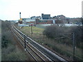
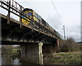
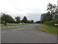
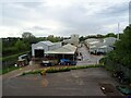
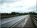
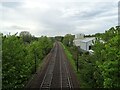
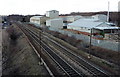
Residents of IP14 2AG have access to a range of amenities within walking or short driving distance. Local retail options include Tesco Stowmarket, East of England Co-operative Co, and Aldi Gipping, providing everyday shopping needs. The area’s rail network, with Stowmarket Railway Station and multiple entrances, connects to nearby towns and cities, facilitating travel for work or leisure. The presence of RAF Wattisham nearby may offer unique opportunities for those interested in military or aviation-related activities. While the area lacks large parks or leisure facilities, its compact size means residents can access local shops, dining options, and transport hubs without long journeys. The mix of retail and rail connectivity supports a practical lifestyle, where convenience outweighs variety. For families, the proximity to schools and shops creates a self-contained environment, though those seeking more extensive recreational spaces may need to travel further. The lifestyle in IP14 2AG is defined by accessibility and simplicity, with a focus on meeting daily needs within a small, cohesive area.
Amenities
Schools
IP14 2AG is served by several primary schools, including Combs Ford Primary School and Trinity Church of England Voluntary Aided Primary School, which holds a good Ofsted rating. The presence of multiple primary schools, including two with good ratings, indicates a strong local education offering for young families. Combs Middle School, though listed as a primary school, may serve as a transitional option for older children. The concentration of schools in the area suggests that education is a priority for residents, with a mix of state and church-affiliated institutions. Families in IP14 2AG benefit from nearby schooling options, though the absence of secondary schools means students may need to travel to neighbouring areas. The good Ofsted rating at Trinity Church of England Voluntary Aided Primary School adds value for parents seeking quality education within walking distance. Overall, the school landscape supports a family-friendly environment, though buyers should consider the need for additional schooling beyond primary level.
| Rank | School | Type | Entry gender | Ages |
|---|---|---|---|---|
| 1 | Combs Ford Primary School | primary | N/A | N/A |
| 2 | Combs Middle School | primary | N/A | N/A |
| 3 | Trinity Church of England Voluntary Aided Primary School | primary | N/A | N/A |
| 4 | Combs Ford Primary School | primary | N/A | N/A |
Explore more schools in this area
Go to Schools tabDemographics
The population of IP14 2AG is 1,600, with a median age of 47, indicating a mature demographic skewed towards adults aged 30–64. This age range dominates, suggesting a community of long-term residents rather than a transient population. Home ownership is high at 78%, with houses being the predominant type of accommodation. The area’s ethnic composition is predominantly White, though no specific data on diversity is provided. The high proportion of owner-occupied homes implies a stable, settled community, with fewer renters or temporary residents. The absence of detailed deprivation data means it is unclear how economic factors influence quality of life, but the age profile and ownership rates suggest a population focused on established living rather than recent migration. The compact size of the area, combined with its mature age demographic, points to a community where familiarity and continuity are key. This profile may appeal to buyers seeking a quiet, low-maintenance environment with minimal turnover.
Household Size
Accommodation Type
Tenure
Ethnic Group
Religion
Household Composition
Age
Household Deprivation
NS-SEC
Explore more demographic insights in this area
Go to Demographics tabPlanning
Planning Constraints
- Flood RiskPremium
- Ramsar Wetland SitesPremium
- Area of Outstanding Natural BeautyPremium
- Protected Nature ReservePremium
- Protected WoodlandPremium
- Crime RiskPremium