Area Overview for IP13 7AQ
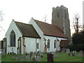
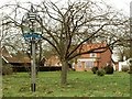
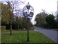
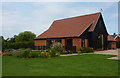
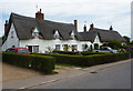
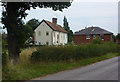
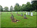
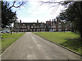
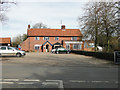
Photos of IP13 7AQ


Area Information
IP13 7AQ is a small, residential postcode area in England, home to around 2,175 people spread across 43 people per square kilometre. This compact cluster of homes suggests a tight-knit community, where daily life is likely shaped by local routines and familiar faces. The area’s modest size means residents are close to amenities and services, though its boundaries are defined by practical reach rather than sprawling development. With a population skewed toward adults aged 30–64, the area reflects a stable, established demographic. Living here offers a balance between suburban tranquillity and proximity to essential services, though the small footprint means the immediate surroundings are key to understanding lifestyle options. The postcode’s character is defined by its housing stock and the presence of nearby schools, which anchor family life. For those seeking a quiet, community-focused environment with minimal urban sprawl, IP13 7AQ presents a focused, manageable living space.
- Area Type
- Postcode
- Area Size
- Not available
- Population
- 2175
- Population Density
- 43 people/km²
IP13 7AQ is primarily an owner-occupied area, with 79% of homes owned by their residents. The accommodation type is predominantly houses, which suggests a focus on family-friendly, standalone properties rather than apartments or terraced housing. This housing stock aligns with the area’s demographic profile of adults aged 30–64, likely reflecting long-term residency and a preference for private, spacious living. The small size of the postcode means the property market is limited in scope, with buyers needing to consider nearby areas for additional options. For those seeking a home in IP13 7AQ, the emphasis on owner-occupation and houses indicates a market suited to those prioritising stability and space over rental flexibility. The compact nature of the area may also mean properties are more likely to be family homes, with potential for long-term value retention.
House Prices in IP13 7AQ
No properties found in this postcode.
Energy Efficiency in IP13 7AQ
Residents of IP13 7AQ have access to a modest range of amenities within practical reach. Retail options include five venues, such as the East of England Co-operative Co and Morrisons Daily Wickham, offering everyday shopping needs. The two nearby railway stations, Entrance and Wickham Market, provide links to broader transport networks, enabling travel to larger towns or cities. While the data does not specify dining or leisure venues, the presence of retail and rail services suggests a functional, community-oriented lifestyle. The area’s compact size means amenities are concentrated, reducing the need for long commutes. For those valuing convenience and proximity to essential services, IP13 7AQ offers a straightforward, accessible environment. However, the absence of detailed information on dining or recreational facilities means residents may need to venture slightly further for a wider range of leisure options.
Amenities
Schools
Residents of IP13 7AQ have access to several primary schools, including Earl Soham Community Primary School, which holds a ‘good’ Ofsted rating, and Easton Community Primary School, Charsfield Church of England Voluntary Controlled Primary School, Easton Primary School, and Charsfield Church of England Primary School. All are primary institutions, offering a range of educational options for younger children. The presence of multiple schools suggests a focus on early education, though secondary schooling is not listed in the data. Families with young children benefit from the proximity of these institutions, though parents may need to look further afield for secondary education. The mix of school types, including church-affiliated options, provides variety in teaching approaches and values. For those prioritising primary education, the area offers a solid foundation, though the absence of secondary schools nearby is a consideration for long-term family planning.
| Rank | School | Type | Entry gender | Ages |
|---|---|---|---|---|
| 1 | Earl Soham Community Primary School | primary | N/A | N/A |
| 2 | Easton Community Primary School | primary | N/A | N/A |
| 3 | Charsfield Church of England Voluntary Controlled Primary School | primary | N/A | N/A |
| 4 | Easton Primary School | primary | N/A | N/A |
| 5 | Charsfield Church of England Primary School | primary | N/A | N/A |
Explore more schools in this area
Go to Schools tabDemographics
The population of IP13 7AQ is predominantly adults, with a median age of 47 and the most common age range being 30–64 years. This suggests a mature, stable community with a strong presence of families and long-term residents. Home ownership is high, at 79%, indicating a preference for settled living over rental properties. The area is characterised by houses rather than flats, reflecting a traditional housing stock. The predominant ethnic group is White, which aligns with broader regional patterns. While no specific data on deprivation is provided, the high home ownership rate and low population density imply a relatively stable quality of life, with fewer pressures associated with overcrowding or transient populations. The age profile suggests a community with established careers and families, likely prioritising security and long-term investment in property.
Household Size
Accommodation Type
Tenure
Ethnic Group
Religion
Household Composition
Age
Household Deprivation
NS-SEC
Explore more demographic insights in this area
Go to Demographics tabPlanning
Planning Constraints
- Flood RiskPremium
- Ramsar Wetland SitesPremium
- Area of Outstanding Natural BeautyPremium
- Protected Nature ReservePremium
- Protected WoodlandPremium
- Crime RiskPremium