Area Overview for IP12 4TH
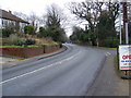
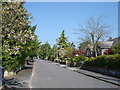
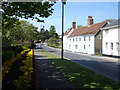
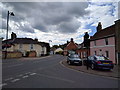
Photos of IP12 4TH


Area Information
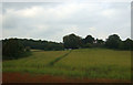
Living in IP12 4TH means inhabiting a small, tightly knit residential cluster in England, where the population of 1,973 residents is spread across a density of 819 people per square kilometre. This area is characterised by its compact size and the prevalence of houses, reflecting a community that values stability and long-term residency. The median age of 47 suggests a mature demographic, with a significant proportion of residents aged 65 and over. Daily life here is likely shaped by the proximity of local amenities and the quiet, residential nature of the postcode. While the area lacks large-scale infrastructure, its small footprint ensures a sense of familiarity and accessibility. For those seeking a low-maintenance, community-focused lifestyle, IP12 4TH offers a blend of practicality and simplicity. Its position as a residential cluster means it is likely surrounded by similar small areas, creating a network of interconnected neighbourhoods. The absence of major urban sprawl here may appeal to those prioritising tranquillity over convenience.
- Area Type
- Postcode
- Area Size
- Not available
- Population
- 1973
- Population Density
- 819 people/km²
The property market in IP12 4TH is dominated by owner-occupied homes, with 77% of residents living in properties they own. This suggests a stable, long-term housing stock where rental demand is likely lower than in more transient areas. The accommodation type is exclusively houses, which contrasts with regions where flats or apartments are more common. For buyers, this means the area is not a hotspot for short-term investment or rental properties but rather a place where homeownership is the norm. Given the small size of the postcode, the housing stock is limited, and buyers may need to consider nearby areas for more options. The focus on houses also implies that properties here are likely to be larger and more established, appealing to those prioritising space and permanence over affordability.
House Prices in IP12 4TH
No properties found in this postcode.
Energy Efficiency in IP12 4TH
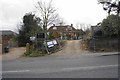
Residents of IP12 4TH have access to a modest but functional range of amenities. Within practical reach are five retail outlets, including the East of England Co-operative Co and Morrisons Daily, offering everyday shopping needs. The presence of multiple rail stations, such as Woodbridge and Melton, enhances mobility, allowing residents to commute to larger towns or cities. While the data does not mention parks or leisure facilities, the proximity to rail networks suggests opportunities for outdoor activities beyond the immediate area. The combination of retail options and transport links creates a lifestyle that balances local convenience with regional accessibility, making daily life in IP12 4TH both practical and manageable.
Amenities
Schools
The nearest school to IP12 4TH is Kingston Middle School, a primary institution. No secondary schools are listed in the data, meaning families with older children may need to look beyond the immediate area for comprehensive education. The presence of a primary school suggests that the area is suitable for young families, though the lack of secondary options could be a limitation for those requiring a full range of educational facilities. The absence of additional schools or Ofsted ratings in the data means it is unclear whether Kingston Middle School meets high standards of performance. For parents, this necessitates careful consideration of commuting distances or the availability of alternative schooling options.
| Rank | School | Type | Entry gender | Ages |
|---|
Explore more schools in this area
Go to Schools tabDemographics
The community in IP12 4TH is predominantly composed of individuals aged 65 and over, with a median age of 47. This suggests a population skewed towards older adults, which may influence local services and social dynamics. Home ownership is high, with 77% of residents living in properties they own, and the accommodation type is primarily houses, indicating a lack of high-density housing such as flats. The predominant ethnic group is White, reflecting a homogenous demographic profile. While this data does not provide specific information on deprivation levels, the high home ownership rate and age profile may imply a stable, long-term resident base with established community ties. The absence of detailed diversity metrics means the area’s cultural composition remains largely unexplored in the provided data.
Household Size
Accommodation Type
Tenure
Ethnic Group
Religion
Household Composition
Age
Household Deprivation
NS-SEC
Explore more demographic insights in this area
Go to Demographics tabPlanning
Planning Constraints
- Flood RiskPremium
- Ramsar Wetland SitesPremium
- Area of Outstanding Natural BeautyPremium
- Protected Nature ReservePremium
- Protected WoodlandPremium