Area Overview for IP12 4RP
Photos of IP12 4RP
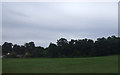
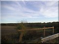
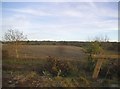
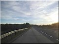
55 photos from this area
Area Information
Key information about the IP12 4RP including its size, population, and administrative classification.
- Area Type
- Postcode
- Area Size
- 14.2 hectares
- Population
- 2348
- Population Density
- 277 people/km²
House Prices in IP12 4RP
10
Properties
£493,000
Average Sold Price
£110,000
Lowest Price
£810,000
Highest Price
Showing 10 properties
| Address | Type | Beds | Baths | Last Sale Price | Last Sale Date | |
|---|---|---|---|---|---|---|
| Chestnut Barn, Bealings Road, Martlesham, IP12 4RP | Semi-detached | 4 | 3 | £810,000 | Apr 2022 | |
| Copper Barn, Bealings Road, Martlesham, IP12 4RP | Semi-detached | 2 | 1 | £675,000 | Mar 2022 | |
| Beacon Hill Farm, Bealings Road, Martlesham, IP12 4RP | Retail | 3 | 3 | £110,000 | Mar 2021 | |
| Dormer House, Bealings Road, Martlesham, IP12 4RP | Detached | 4 | 1 | £385,000 | Aug 2018 | |
| Meadow Barn, Bealings Road, Martlesham, IP12 4RP | Semi-detached | 4 | 3 | £485,000 | May 2017 | |
| Workshop Rear Of, Beacon Hill Farm, Bealings Road, Martlesham, IP12 4RP | Industrial | - | - | - | - | |
| Bealings Farm Shop And Cafe, Bealings Road, Martlesham, IP12 4RP | retail_financial | - | - | - | - | |
| The Granary, Bealings Road, Martlesham, IP12 4RP | Detached | - | - | - | - | |
| Beacon Hill House, Bealings Road, Martlesham, IP12 4RP | Detached | - | - | - | - | |
| Holly Barn, Bealings Road, Martlesham, IP12 4RP | Semi-detached | 2 | 1 | - | - |
Energy Efficiency in IP12 4RP
Amenities
Schools
| Rank | School | Type | Entry gender | Ages |
|---|
Explore more schools in this area
Go to Schools tabDemographics
Household Size
Two person
most common
Accommodation Type
Houses
most common
Tenure
85
majority
Ethnic Group
White
most common
Religion
N/A
most common
Household Composition
N/A
most common
Age
47
median
Adults (30-64 years)
most common
Household Deprivation
N/A
with no deprivation
NS-SEC
38
in Lower managerial occupations
Explore more demographic insights in this area
Go to Demographics tabPlanning
Planning Constraints
- Flood RiskPremium
- Ramsar Wetland SitesPremium
- Area of Outstanding Natural BeautyPremium
- Protected Nature ReservePremium
- Protected WoodlandPremium