Area Overview for IP12 3DJ
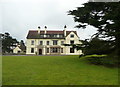
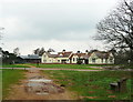
Photos of IP12 3DJ
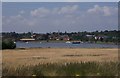
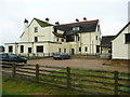
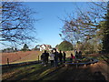
![Sutton Hoo site [10] in IP12 3DJ](https://images.propbar.co.uk/images/geograph/51/16/5116601_120.jpg)
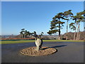
100 photos from this area
Area Information
Key information about the IP12 3DJ including its size, population, and administrative classification.
- Area Type
- Postcode
- Area Size
- 1.6 km²
- Population
- 1285
- Population Density
- 26 people/km²
House Prices in IP12 3DJ
20
Properties
£1,045,000
Average Sold Price
£1,045,000
Lowest Price
£1,045,000
Highest Price
Showing 20 properties
| Address | Type | Beds | Baths | Last Sale Price | Last Sale Date | |
|---|---|---|---|---|---|---|
| Little Sutton Hoo, Sutton Hoo, Sutton, IP12 3DJ | house | 5 | - | £1,045,000 | Dec 2011 | |
| Little Haugh, Sutton Hoo, Sutton, IP12 3DJ | Detached | 7 | 4 | - | - | |
| Dairy Cottage, Sutton Hoo, Sutton, IP12 3DJ | Bungalow | 4 | - | - | - | |
| Caravan At Lucerne Barn, Castle Farm, Sutton Hoo, Sutton, IP12 3DJ | Mobile Home | - | - | - | - | |
| The Bungalow, Castle Farm, Sutton Hoo, Sutton, IP12 3DJ | undefined | - | - | - | - | |
| Managers Flat, Tranmer House, Sutton Hoo, Sutton, IP12 3DJ | Flat | - | - | - | - | |
| First Floor Flat, The Coach House, Sutton Hoo, Sutton, IP12 3DJ | Flat | - | - | - | - | |
| Wilford Holiday Let, Tranmer House, Sutton Hoo, Sutton, IP12 3DJ | hotel | - | - | - | - | |
| Kyson Holiday Let, Tranmer House, Sutton Hoo, Sutton, IP12 3DJ | hotel | - | - | - | - | |
| Sutton Hoo House, Sutton Hoo, Sutton, IP12 3DJ | undefined | - | - | - | - |
Page 1 of 2
Energy Efficiency in IP12 3DJ
Amenities
Schools
| Rank | School | Type | Entry gender | Ages |
|---|
Explore more schools in this area
Go to Schools tabDemographics
Household Size
Two person
most common
Accommodation Type
Houses
most common
Tenure
68
majority
Ethnic Group
White
most common
Religion
N/A
most common
Household Composition
N/A
most common
Age
47
median
Adults (30-64 years)
most common
Household Deprivation
N/A
with no deprivation
NS-SEC
38
in Lower managerial occupations
Explore more demographic insights in this area
Go to Demographics tabPlanning
Planning Constraints
- Flood RiskPremium
- Ramsar Wetland SitesPremium
- Area of Outstanding Natural BeautyPremium
- Protected Nature ReservePremium
- Protected WoodlandPremium