Area Overview for IP12 3BL
Photos of IP12 3BL
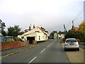


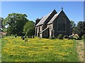
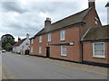
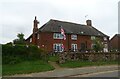
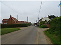
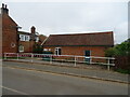
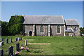
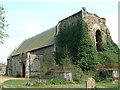
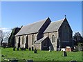
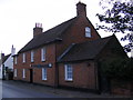
34 photos from this area
Area Information
Key information about the IP12 3BL including its size, population, and administrative classification.
- Area Type
- Postcode
- Area Size
- 96.1 hectares
- Population
- 1285
- Population Density
- 26 people/km²
House Prices in IP12 3BL
58
Properties
£378,350
Average Sold Price
£40,000
Lowest Price
£1,400,000
Highest Price
Showing 58 properties
| Address | Type | Beds | Baths | Last Sale Price | Last Sale Date | |
|---|---|---|---|---|---|---|
| Stangrove Hall, The Street, Alderton, IP12 3BL | Detached | - | - | £1,050,000 | Aug 2024 | |
| 1, Model Cottages, The Street, Alderton, IP12 3BL | house | - | - | £360,000 | Jul 2024 | |
| Swift Cottage, 43 The Street, Alderton, IP12 3BL | Detached | 3 | 2 | £475,000 | Jun 2023 | |
| CHAPEL HOUSE, THE STREET, Alderton, IP12 3BL | Detached | - | - | £550,000 | Jun 2022 | |
| Brandywell, 42A The Street, Alderton, IP12 3BL | Bungalow | 2 | 2 | £310,000 | Nov 2021 | |
| Stanley House, The Street, Alderton, IP12 3BL | house | - | - | £665,000 | Sep 2021 | |
| Manor House, The Street, Alderton, IP12 3BL | house | - | - | £1,400,000 | Apr 2021 | |
| Pitcairn Cottages, 44-45 The Street, Alderton, IP12 3BL | Detached | 4 | 2 | £470,000 | Mar 2021 | |
| Twenty Minute Cottage, The Street, Alderton, IP12 3BL | house | 3 | 2 | £230,600 | Jan 2021 | |
| Prudence Cottage, The Street, Alderton, IP12 3BL | house | - | - | £176,000 | Dec 2020 |
Page 1 of 6
Energy Efficiency in IP12 3BL
Amenities
Schools
| Rank | School | Type | Entry gender | Ages |
|---|
Explore more schools in this area
Go to Schools tabDemographics
Household Size
Two person
most common
Accommodation Type
Houses
most common
Tenure
68
majority
Ethnic Group
White
most common
Religion
N/A
most common
Household Composition
N/A
most common
Age
47
median
Adults (30-64 years)
most common
Household Deprivation
N/A
with no deprivation
NS-SEC
38
in Lower managerial occupations
Explore more demographic insights in this area
Go to Demographics tabPlanning
Planning Constraints
- Flood RiskPremium
- Ramsar Wetland SitesPremium
- Area of Outstanding Natural BeautyPremium
- Protected Nature ReservePremium
- Protected WoodlandPremium