Area Overview for IP12 2PF
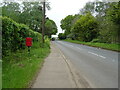
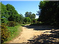
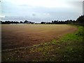
Photos of IP12 2PF

Area Information
IP12 2PF is a small residential cluster in England, covering 15 hectares and home to 1,589 residents. The area’s compact size means it offers a close-knit community feel, with a population density of 212 people per square kilometre. This postcode is characterised by a mature demographic, with a median age of 47 and a majority of residents aged between 30 and 64. The area is predominantly owner-occupied, with 59% of homes owned by residents, and most properties are houses rather than flats. Living here means access to nearby amenities such as railway stations, retail stores, and two schools, including Sandlings Primary School, which has a good Ofsted rating. The area’s proximity to Melton Railway Station and other nearby stations provides connections to larger towns, while local shops like Morrisons and Spar cater to daily needs. Despite its small footprint, IP12 2PF balances residential tranquillity with practical access to services, making it suitable for those seeking a settled lifestyle without sacrificing convenience.
- Area Type
- Postcode
- Area Size
- 15.0 hectares
- Population
- 1589
- Population Density
- 212 people/km²
The property market in IP12 2PF is dominated by owner-occupied homes, with 59% of properties owned by residents. This suggests a stable market where long-term residents are more common than renters, which may influence demand for family homes or investment properties. The accommodation type is predominantly houses, reflecting a preference for larger, private dwellings over flats or apartments. Given the area’s small size, the housing stock is likely limited, with limited scope for new developments due to the Area of Outstanding Natural Beauty designation. Buyers should consider that the market may cater more to those seeking established homes rather than speculative purchases. The presence of nearby amenities such as schools and retail stores adds to the area’s appeal, though the low broadband score may be a consideration for those reliant on high-speed internet for work or leisure.
House Prices in IP12 2PF
Showing 2 properties
| Address | Type | Beds | Baths | Last Sale Price | Last Sale Date | |
|---|---|---|---|---|---|---|
| Park View, Orford Road, Bromeswell, IP12 2PF | Detached | - | - | - | - | |
| Flat, Woodbridge Golf Club, Orford Road, Bromeswell, IP12 2PF | Flat | - | - | - | - |
Energy Efficiency in IP12 2PF
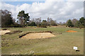
Residents of IP12 2PF benefit from nearby amenities that support a practical lifestyle. The area’s retail options include Morrisons, The STR, Spar, and the East of England Co-operative, offering a range of shopping and convenience services. The five railway stations provide access to public transport, enabling travel to larger towns for work, leisure, or socialising. While the area’s small size means limited local parks or leisure facilities, the proximity to an Area of Outstanding Natural Beauty may offer nearby outdoor spaces for walking or recreation. The mix of retail and transport options ensures daily needs are met without extensive travel, contributing to a self-contained yet connected lifestyle.
Amenities
Schools
Residents of IP12 2PF have access to two schools within practical reach. Sandlings Primary School, a state-funded primary school, holds a good Ofsted rating, indicating a reliable and high-quality education for younger children. For families seeking alternative educational options, Faith Christian Academy, an independent school, offers another choice. The mix of state and independent schools provides flexibility, allowing parents to select between publicly funded education and private institutions. Both schools are likely to serve the local community, with Sandlings Primary’s good rating suggesting strong academic performance and resources. The proximity of these schools to the area makes IP12 2PF an attractive option for families prioritising educational quality and variety.
| Rank | School | Type | Entry gender | Ages |
|---|
Explore more schools in this area
Go to Schools tabDemographics
The community in IP12 2PF is defined by its age profile, with a median age of 47 and the majority of residents falling within the 30-64 age range. This suggests a population skewed towards adults, likely including families and professionals in their middle years. Home ownership is strong, with 59% of residents owning their homes, indicating a stable housing market. The accommodation type is predominantly houses, which aligns with the area’s residential character. The predominant ethnic group is White, though no further breakdown of diversity is provided in the data. The population density of 212 people per square kilometre implies a moderate level of urbanisation, balancing private space with community interaction. For quality of life, the low crime risk score of 91 and the absence of flood or environmental risks suggest a generally secure and low-stress living environment. However, the area’s inclusion within an Area of Outstanding Natural Beauty may influence planning restrictions, which could affect future development or property modifications.
Household Size
Accommodation Type
Tenure
Ethnic Group
Religion
Household Composition
Age
Household Deprivation
NS-SEC
Explore more demographic insights in this area
Go to Demographics tabPlanning
Planning Constraints
- Flood RiskPremium
- Ramsar Wetland SitesPremium
- Area of Outstanding Natural BeautyPremium
- Protected Nature ReservePremium
- Protected WoodlandPremium