Area Overview for IP12 1HB
Photos of IP12 1HB


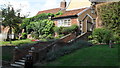

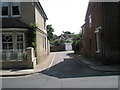

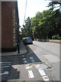
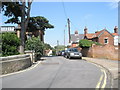

100 photos from this area
Area Information
Key information about the IP12 1HB including its size, population, and administrative classification.
- Area Type
- Postcode
- Area Size
- 1.5 hectares
- Population
- 1915
- Population Density
- 3204 people/km²
House Prices in IP12 1HB
30
Properties
£174,963
Average Sold Price
£87,500
Lowest Price
£235,000
Highest Price
Showing 30 properties
| Address | Type | Beds | Baths | Last Sale Price | Last Sale Date | |
|---|---|---|---|---|---|---|
| 14, Elmhurst Court, Hamblin Road, Woodbridge, IP12 1HB | Flat | - | - | £175,000 | Sep 2025 | |
| 23, Elmhurst Court, Hamblin Road, Woodbridge, IP12 1HB | Flat | 2 | 1 | £200,000 | Jun 2025 | |
| 26, Elmhurst Court, Hamblin Road, Woodbridge, IP12 1HB | Flat | - | - | £131,500 | Dec 2024 | |
| 6, Elmhurst Court, Hamblin Road, Woodbridge, IP12 1HB | Flat | - | - | £160,000 | Dec 2024 | |
| 18, Elmhurst Court, Hamblin Road, Woodbridge, IP12 1HB | Flat | - | - | £138,000 | Jul 2024 | |
| 5, Elmhurst Court, Hamblin Road, Woodbridge, IP12 1HB | Flat | - | - | £170,000 | Oct 2023 | |
| 17, Elmhurst Court, Hamblin Road, Woodbridge, IP12 1HB | Retail | 1 | 1 | £145,000 | Dec 2022 | |
| 20, Elmhurst Court, Hamblin Road, Woodbridge, IP12 1HB | Retail | 1 | 1 | £140,000 | Oct 2022 | |
| 13, Elmhurst Court, Hamblin Road, Woodbridge, IP12 1HB | Flat | 1 | 1 | £165,000 | Sep 2022 | |
| 3, Elmhurst Court, Hamblin Road, Woodbridge, IP12 1HB | Flat | - | - | £232,500 | Aug 2022 |
Page 1 of 3
Energy Efficiency in IP12 1HB
Amenities
Schools
| Rank | School | Type | Entry gender | Ages |
|---|
Explore more schools in this area
Go to Schools tabDemographics
Household Size
One person
most common
Accommodation Type
Houses
most common
Tenure
62
majority
Ethnic Group
White
most common
Religion
N/A
most common
Household Composition
N/A
most common
Age
47
median
Adults (30-64 years)
most common
Household Deprivation
N/A
with no deprivation
NS-SEC
47
in Lower managerial occupations
Explore more demographic insights in this area
Go to Demographics tabPlanning
Planning Constraints
- Flood RiskPremium
- Ramsar Wetland SitesPremium
- Area of Outstanding Natural BeautyPremium
- Protected Nature ReservePremium
- Protected WoodlandPremium