Area Overview for IP11 9QF
Photos of IP11 9QF
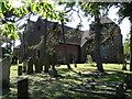
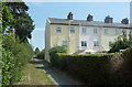
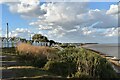
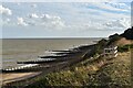
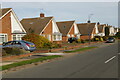
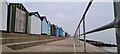
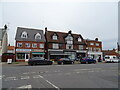
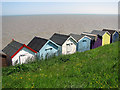
37 photos from this area
Area Information
Key information about the IP11 9QF including its size, population, and administrative classification.
- Area Type
- Postcode
- Area Size
- 1.4 hectares
- Population
- 2310
- Population Density
- 2395 people/km²
House Prices in IP11 9QF
22
Properties
£260,542
Average Sold Price
£74,000
Lowest Price
£370,000
Highest Price
Showing 22 properties
| Address | Type | Beds | Baths | Last Sale Price | Last Sale Date | |
|---|---|---|---|---|---|---|
| 67 Looe Road, Felixstowe, IP11 9QF | Bungalow | - | - | £370,000 | Aug 2019 | |
| 57 Looe Road, Felixstowe, IP11 9QF | Detached | 4 | 1 | £345,000 | Oct 2018 | |
| 61 Looe Road, Felixstowe, IP11 9QF | house | - | - | £346,500 | Aug 2018 | |
| Charnwood, 88 Looe Road, Felixstowe, IP11 9QF | Detached | 4 | 1 | £360,000 | Feb 2016 | |
| 79 Looe Road, Felixstowe, IP11 9QF | Bungalow | 3 | 2 | £275,000 | Dec 2015 | |
| 98 Looe Road, Felixstowe, IP11 9QF | Bungalow | 3 | - | £260,000 | May 2014 | |
| 69 Looe Road, Felixstowe, IP11 9QF | Bungalow | - | - | £197,500 | Aug 2009 | |
| 71 Looe Road, Felixstowe, IP11 9QF | Detached | - | - | £213,000 | Nov 2006 | |
| 75 Looe Road, Felixstowe, IP11 9QF | Detached | - | - | £272,500 | Sep 2004 | |
| 65 Looe Road, Felixstowe, IP11 9QF | Semi-detached | - | - | £277,500 | Mar 2004 |
Page 1 of 3
Energy Efficiency in IP11 9QF
Amenities
Schools
| Rank | School | Type | Entry gender | Ages |
|---|
Explore more schools in this area
Go to Schools tabDemographics
Household Size
Two person
most common
Accommodation Type
Houses
most common
Tenure
83
majority
Ethnic Group
White
most common
Religion
N/A
most common
Household Composition
N/A
most common
Age
47
median
Elderly (65+ years)
most common
Household Deprivation
N/A
with no deprivation
NS-SEC
37
in Lower managerial occupations
Explore more demographic insights in this area
Go to Demographics tabPlanning
Planning Constraints
- Flood RiskPremium
- Ramsar Wetland SitesPremium
- Area of Outstanding Natural BeautyPremium
- Protected Nature ReservePremium
- Protected WoodlandPremium