Area Overview for IP11 2ND
Photos of IP11 2ND

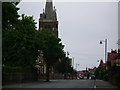
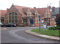
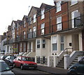
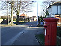
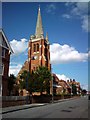
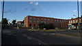
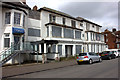
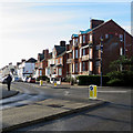
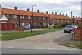
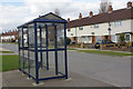
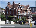
41 photos from this area
Area Information
Key information about the IP11 2ND including its size, population, and administrative classification.
- Area Type
- Postcode
- Area Size
- 4.9 hectares
- Population
- 1697
- Population Density
- 1753 people/km²
House Prices in IP11 2ND
14
Properties
£212,400
Average Sold Price
£82,000
Lowest Price
£320,000
Highest Price
Showing 14 properties
| Address | Type | Beds | Baths | Last Sale Price | Last Sale Date | |
|---|---|---|---|---|---|---|
| 45 Langley Avenue, Felixstowe, IP11 2ND | Semi-detached | 3 | 1 | £320,000 | May 2024 | |
| 51 Langley Avenue, Felixstowe, IP11 2ND | Semi-detached | 3 | 1 | £260,000 | Dec 2018 | |
| 43 Langley Avenue, Felixstowe, IP11 2ND | Semi-detached | 3 | 2 | £225,000 | May 2015 | |
| 59 Langley Avenue, Felixstowe, IP11 2ND | Semi-detached | - | - | £175,000 | Jul 2012 | |
| 55 Langley Avenue, Felixstowe, IP11 2ND | Semi-detached | - | - | £82,000 | Apr 2001 | |
| 49 Langley Avenue, Felixstowe, IP11 2ND | Semi-detached | 3 | 1 | - | - | |
| Pavilion, Langley Avenue, Felixstowe, IP11 2ND | Leisure | - | - | - | - | |
| 41 Langley Avenue, Felixstowe, IP11 2ND | Semi-detached | - | - | - | - | |
| 70 Langley Avenue, Felixstowe, IP11 2ND | Semi-detached | - | - | - | - | |
| 47 Langley Avenue, Felixstowe, IP11 2ND | Semi-detached | - | - | - | - |
Page 1 of 2
Energy Efficiency in IP11 2ND
Amenities
Schools
| Rank | School | Type | Entry gender | Ages |
|---|
Explore more schools in this area
Go to Schools tabDemographics
Household Size
Two person
most common
Accommodation Type
Houses
most common
Tenure
47
majority
Ethnic Group
White
most common
Religion
N/A
most common
Household Composition
N/A
most common
Age
47
median
Adults (30-64 years)
most common
Household Deprivation
N/A
with no deprivation
NS-SEC
17
in Lower managerial occupations
Explore more demographic insights in this area
Go to Demographics tabPlanning
Planning Constraints
- Flood RiskPremium
- Ramsar Wetland SitesPremium
- Area of Outstanding Natural BeautyPremium
- Protected Nature ReservePremium
- Protected WoodlandPremium