Area Overview for IP11 0TW
Photos of IP11 0TW

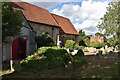
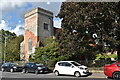
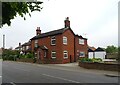
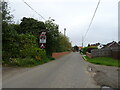
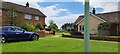
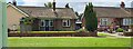
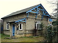
29 photos from this area
Area Information
Key information about the IP11 0TW including its size, population, and administrative classification.
- Area Type
- Postcode
- Area Size
- 2.9 hectares
- Population
- 1676
- Population Density
- 719 people/km²
House Prices in IP11 0TW
25
Properties
£311,542
Average Sold Price
£184,000
Lowest Price
£475,000
Highest Price
Showing 25 properties
| Address | Type | Beds | Baths | Last Sale Price | Last Sale Date | |
|---|---|---|---|---|---|---|
| 147 High Road, Trimley St Mary, IP11 0TW | house | 6 | 4 | £475,000 | Jan 2025 | |
| 169 High Road, Trimley St Mary, IP11 0TW | house | 3 | - | £285,000 | Jun 2021 | |
| 175 High Road, Trimley St Mary, IP11 0TW | Detached | 2 | 1 | £395,000 | Apr 2017 | |
| 163 High Road, Trimley St Mary, IP11 0TW | Bungalow | 5 | 2 | £343,000 | Nov 2015 | |
| 151 High Road, Trimley St Mary, IP11 0TW | house | - | - | £210,000 | Nov 2015 | |
| 175A High Road, Trimley St Mary, IP11 0TW | Detached | 3 | 1 | £235,000 | Jan 2014 | |
| 173 High Road, Trimley St Mary, IP11 0TW | house | - | - | £315,000 | Mar 2013 | |
| 165 High Road, Trimley St Mary, IP11 0TW | house | - | - | £184,000 | Oct 2009 | |
| Laudsdale, 3 Lauds Close, Trimley St Mary, IP11 0TW | Detached | - | - | £445,000 | Dec 2008 | |
| 153 High Road, Trimley St Mary, IP11 0TW | Detached | - | - | £270,000 | Feb 2006 |
Page 1 of 3
Energy Efficiency in IP11 0TW
Amenities
Schools
| Rank | School | Type | Entry gender | Ages |
|---|
Explore more schools in this area
Go to Schools tabDemographics
Household Size
Two person
most common
Accommodation Type
Houses
most common
Tenure
62
majority
Ethnic Group
White
most common
Religion
N/A
most common
Household Composition
N/A
most common
Age
47
median
Adults (30-64 years)
most common
Household Deprivation
N/A
with no deprivation
NS-SEC
32
in Lower managerial occupations
Explore more demographic insights in this area
Go to Demographics tabPlanning
Planning Constraints
- Flood RiskPremium
- Ramsar Wetland SitesPremium
- Area of Outstanding Natural BeautyPremium
- Protected Nature ReservePremium
- Protected WoodlandPremium