Area Overview for IP11 0RG
Photos of IP11 0RG
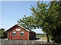
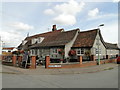
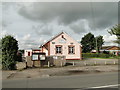
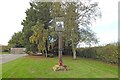

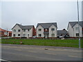
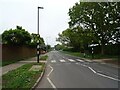
95 photos from this area
Area Information
Key information about the IP11 0RG including its size, population, and administrative classification.
- Area Type
- Postcode
- Area Size
- 5.0 hectares
- Population
- 1676
- Population Density
- 719 people/km²
House Prices in IP11 0RG
34
Properties
£260,700
Average Sold Price
£85,000
Lowest Price
£400,000
Highest Price
Showing 34 properties
| Address | Type | Beds | Baths | Last Sale Price | Last Sale Date | |
|---|---|---|---|---|---|---|
| 266 High Road, Trimley St Martin, IP11 0RG | house | - | - | £350,000 | Dec 2023 | |
| 220 High Road, Trimley St Martin, IP11 0RG | Semi-detached | 3 | 1 | £400,000 | Dec 2022 | |
| 222 High Road, Trimley St Martin, IP11 0RG | Semi-detached | 3 | 2 | £397,000 | Feb 2022 | |
| 264 High Road, Trimley St Martin, IP11 0RG | Detached | 3 | 1 | £350,000 | Jun 2021 | |
| 260 High Road, Trimley St Martin, IP11 0RG | Detached | 3 | 2 | £200,000 | Feb 2020 | |
| 214 High Road, Trimley St Martin, IP11 0RG | Terraced | 3 | 1 | £185,000 | Jul 2018 | |
| 268 High Road, Trimley St Martin, IP11 0RG | Detached | 3 | 1 | £260,000 | Feb 2018 | |
| 226 High Road, Trimley St Martin, IP11 0RG | Terraced | 1 | 1 | £127,000 | Feb 2018 | |
| 242A High Road, Trimley St Martin, IP11 0RG | undefined | - | - | £333,500 | Apr 2014 | |
| 258A High Road, Trimley St Martin, IP11 0RG | Detached | 3 | - | £350,000 | Aug 2012 |
Page 1 of 4
Energy Efficiency in IP11 0RG
Amenities
Schools
| Rank | School | Type | Entry gender | Ages |
|---|
Explore more schools in this area
Go to Schools tabDemographics
Household Size
Two person
most common
Accommodation Type
Houses
most common
Tenure
62
majority
Ethnic Group
White
most common
Religion
N/A
most common
Household Composition
N/A
most common
Age
47
median
Adults (30-64 years)
most common
Household Deprivation
N/A
with no deprivation
NS-SEC
32
in Lower managerial occupations
Explore more demographic insights in this area
Go to Demographics tabPlanning
Planning Constraints
- Flood RiskPremium
- Ramsar Wetland SitesPremium
- Area of Outstanding Natural BeautyPremium
- Protected Nature ReservePremium
- Protected WoodlandPremium