Area Overview for IP10 0WH
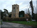
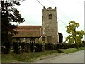
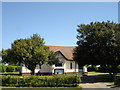
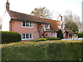
Photos of IP10 0WH


Area Information
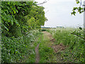
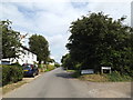
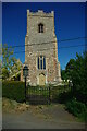
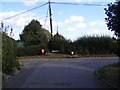
IP10 0WH is a small, tightly knit residential postcode area in England, home to 1,432 people spread across 99 people per square kilometre. This compact cluster of homes reflects a quiet, low-density living environment, typical of rural or semi-rural settings. The area’s character is defined by its modest scale and the presence of houses rather than flats, suggesting a community focused on family-oriented living. With a median age of 47 and a majority of residents aged 30–64, the area is populated by adults in their prime working years, many of whom own their homes. Daily life here is likely shaped by proximity to nearby amenities, including retail outlets, rail services, and ferry access. The low population density and absence of major urban infrastructure mean IP10 0WH is not a bustling hub but a place where neighbours are likely to know one another. Its small size and limited development suggest a stable, unchanging environment, ideal for those seeking a peaceful, community-driven lifestyle away from city centres.
- Area Type
- Postcode
- Area Size
- Not available
- Population
- 1432
- Population Density
- 99 people/km²
The property market in IP10 0WH is characterised by a high rate of home ownership, with 79% of residents living in homes they own. This suggests a community of long-term residents rather than a transient rental market. The accommodation type is predominantly houses, which implies a more spacious, traditional housing stock compared to areas with a higher proportion of flats. As a small postcode area, the number of properties available is likely limited, making it a niche market for buyers seeking a quiet, low-density environment. The absence of major planning constraints, such as protected woodlands or areas of outstanding natural beauty, means development restrictions are minimal. However, the small size of the area and its focus on owner-occupation suggest that property prices may be influenced more by local demand than by broader regional trends. Buyers should consider the limited availability of properties and the potential for a slower-moving market.
House Prices in IP10 0WH
No properties found in this postcode.
Energy Efficiency in IP10 0WH
Residents of IP10 0WH have access to a range of local amenities that support a practical, community-focused lifestyle. Retail options include Morrisons Daily, East of England Co-operative Co, and other local stores, providing essential shopping within walking or short driving distance. The area’s rail connections, such as Trimley Railway Station, offer links to nearby towns and cities, while ferry services like Bawdsey Ferry Landing and Shotley Point Marina provide direct access to coastal routes. These transport links suggest a balance between rural tranquillity and connectivity to larger centres. The presence of multiple retail and transport hubs indicates that daily needs can be met locally, reducing the need for long commutes. The modest scale of the area means amenities are not sprawling, but they are sufficient for a low-key, self-sufficient lifestyle. The combination of shops, rail, and ferry access creates a convenient environment for those who value accessibility without the hustle of a major urban area.
Amenities
Schools
| Rank | School | Type | Entry gender | Ages |
|---|
Explore more schools in this area
Go to Schools tabDemographics
The population of IP10 0WH is predominantly adults aged 30–64, with a median age of 47. This suggests a mature, established community with a strong presence of middle-aged residents, many of whom may be in their peak earning years. Home ownership is high, with 79% of households owning their properties, indicating a stable, long-term resident base. The area is composed almost entirely of houses, which contrasts with regions where flats or apartments dominate. The predominant ethnic group is White, reflecting a homogenous demographic profile. There is no specific data on deprivation levels, but the high home ownership rate and absence of significant planning constraints suggest a relatively affluent or stable area. The lack of younger demographics or younger families may mean fewer schools or childcare facilities, though this is not explicitly stated in the data.
Household Size
Accommodation Type
Tenure
Ethnic Group
Religion
Household Composition
Age
Household Deprivation
NS-SEC
Explore more demographic insights in this area
Go to Demographics tabPlanning
Planning Constraints
- Flood RiskPremium
- Ramsar Wetland SitesPremium
- Area of Outstanding Natural BeautyPremium
- Protected Nature ReservePremium
- Protected WoodlandPremium