Area Overview for IP10 0EU
Photos of IP10 0EU
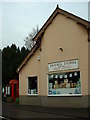
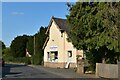
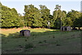
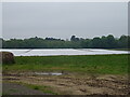
13 photos from this area
Area Information
Key information about the IP10 0EU including its size, population, and administrative classification.
- Area Type
- Postcode
- Area Size
- 22.2 hectares
- Population
- 1817
- Population Density
- 68 people/km²
House Prices in IP10 0EU
45
Properties
£469,200
Average Sold Price
£165,000
Lowest Price
£675,000
Highest Price
Showing 45 properties
| Address | Type | Beds | Baths | Last Sale Price | Last Sale Date | |
|---|---|---|---|---|---|---|
| Westbank, The Street, Nacton, IP10 0EU | Detached | 4 | - | £660,000 | Mar 2016 | |
| Anchor House, The Street, Nacton, IP10 0EU | house | - | - | £450,000 | Mar 2016 | |
| Heol Nant, The Street, Nacton, IP10 0EU | Detached | 5 | - | £375,000 | Feb 2016 | |
| Greenways, The Street, Nacton, IP10 0EU | house | 4 | 3 | £635,000 | Nov 2015 | |
| Dunelm, The Street, Nacton, IP10 0EU | Detached | 4 | 3 | £660,000 | Dec 2014 | |
| Sun House, The Street, Nacton, IP10 0EU | house | - | - | £202,000 | Oct 2014 | |
| Nightingale Cottage, The Street, Nacton, IP10 0EU | Bungalow | 4 | - | £530,000 | Oct 2013 | |
| Southbank, The Street, Nacton, IP10 0EU | Detached | 4 | 3 | £675,000 | Jun 2011 | |
| Chez Nous, The Street, Nacton, IP10 0EU | Detached | 4 | 2 | £340,000 | Apr 2010 | |
| The Horseshoes, The Street, Nacton, IP10 0EU | Detached | - | - | £165,000 | Feb 1997 |
Page 1 of 5
Energy Efficiency in IP10 0EU
Amenities
Schools
| Rank | School | Type | Entry gender | Ages |
|---|
Explore more schools in this area
Go to Schools tabDemographics
Household Size
Two person
most common
Accommodation Type
Houses
most common
Tenure
84
majority
Ethnic Group
White
most common
Religion
N/A
most common
Household Composition
N/A
most common
Age
47
median
Adults (30-64 years)
most common
Household Deprivation
N/A
with no deprivation
NS-SEC
44
in Lower managerial occupations
Explore more demographic insights in this area
Go to Demographics tabPlanning
Planning Constraints
- Flood RiskPremium
- Ramsar Wetland SitesPremium
- Area of Outstanding Natural BeautyPremium
- Protected Nature ReservePremium
- Protected WoodlandPremium