Area Overview for IP1 5NT
Photos of IP1 5NT


Area Information
Living in IP1 5NT means inhabiting a tightly packed residential cluster in England’s eastern region. With a population of 1,490 spread across just 1 hectare, this area is exceptionally dense, translating to 143,328 people per square kilometre. Such proximity creates a compact, almost village-like atmosphere, though the small size means the community is limited in scale. The area is defined by its practicality: residents are close to essential services, including retail outlets like Asda Ipswich and Lidl Ipswich, as well as railway stations such as Entrance2 and Westerfield Railway Station. Daily life here is likely shaped by the need for efficiency, with amenities within walking or short driving distance. The demographic skew toward adults aged 30–64 suggests a mature, possibly professional or retired population, which may influence the area’s social dynamics. While the high density could feel cramped, the presence of rail links and retail options offers convenience for those prioritising accessibility over expansive living space.
- Area Type
- Postcode
- Area Size
- 1.0 hectares
- Population
- 1490
- Population Density
- 1573 people/km²
The property market in IP1 5NT is characterised by a 41% home ownership rate, suggesting that over half of the housing stock is rented. This points to a market that is more rental-focused than owner-occupied, which could be due to the area’s compact size and limited housing availability. The accommodation type is predominantly houses, though the small area size and high population density imply these are likely modest properties, such as terraced or semi-detached homes. Buyers in this area should expect a limited selection of properties, with competition likely among renters and those seeking short-term or investment opportunities. The small footprint of IP1 5NT means that properties are closely spaced, which may appeal to those prioritising convenience and proximity to amenities but could be a drawback for those seeking more private or expansive living spaces.
House Prices in IP1 5NT
No properties found in this postcode.
Energy Efficiency in IP1 5NT
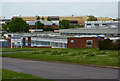
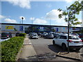
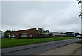
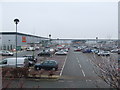
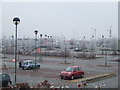
Residents of IP1 5NT have access to a range of nearby amenities within practical reach. Retail options include Asda Ipswich, Lidl Ipswich, and the East of England Co-operative Co, providing essential shopping and grocery needs. The area’s rail links, such as Entrance2 and Westerfield Railway Station, offer direct access to regional transport, facilitating travel to nearby towns and cities. While the data does not specify parks or leisure facilities, the proximity to retail and transport hubs suggests a lifestyle focused on convenience and efficiency. The compact nature of the area means that daily errands and commuting are likely manageable without a car. However, the lack of detailed information on recreational spaces or dining options leaves some aspects of lifestyle unexplored, though the existing amenities indicate a practical, service-oriented community.
Amenities
Schools
| Rank | School | Type | Entry gender | Ages |
|---|
Explore more schools in this area
Go to Schools tabDemographics
IP1 5NT’s population of 1,490 is predominantly composed of adults aged 30–64, with a median age of 47. This suggests a mature community, likely with a mix of professionals, retirees, and long-term residents. Home ownership here is relatively low, at 41%, indicating that a significant portion of the housing stock is rented. The accommodation type is primarily houses, though the area’s small size and high density imply these are likely smaller, single-family homes or terraced properties. The predominant ethnic group is White, with no data provided on other demographics. The population density of 143,328 people per square kilometre is exceptionally high, which may impact living conditions, such as limited private outdoor space. This density could also contribute to a tightly knit community, though it may challenge those seeking more spacious or suburban environments.
Household Size
Accommodation Type
Tenure
Ethnic Group
Religion
Household Composition
Age
Household Deprivation
NS-SEC
Explore more demographic insights in this area
Go to Demographics tabPlanning
Planning Constraints
- Flood RiskPremium
- Ramsar Wetland SitesPremium
- Area of Outstanding Natural BeautyPremium
- Protected Nature ReservePremium
- Protected WoodlandPremium
- Crime RiskPremium