Area Overview for IP1 5AU
Photos of IP1 5AU
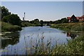
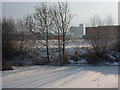
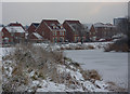
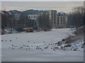
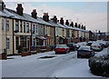
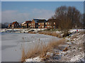
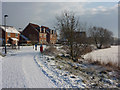
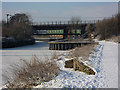
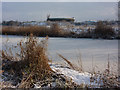
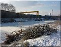
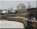
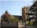
65 photos from this area
Area Information
Key information about the IP1 5AU including its size, population, and administrative classification.
- Area Type
- Postcode
- Area Size
- 1.9 hectares
- Population
- 2072
- Population Density
- 3963 people/km²
House Prices in IP1 5AU
70
Properties
£158,935
Average Sold Price
£29,500
Lowest Price
£1,765,000
Highest Price
Showing 70 properties
| Address | Type | Beds | Baths | Last Sale Price | Last Sale Date | |
|---|---|---|---|---|---|---|
| 445 Bramford Road, Ipswich, IP1 5AU | Terraced | 2 | 1 | £1,765,000 | Dec 2025 | |
| 475 Bramford Road, Ipswich, IP1 5AU | Terraced | 2 | 1 | £175,000 | Nov 2024 | |
| 531 Bramford Road, Ipswich, IP1 5AU | Terraced | 2 | 1 | £180,000 | Apr 2024 | |
| 487 Bramford Road, Ipswich, IP1 5AU | house | 2 | 1 | £180,000 | Mar 2024 | |
| 549 Bramford Road, Ipswich, IP1 5AU | Detached | 5 | 1 | £255,000 | Nov 2023 | |
| 493 Bramford Road, Ipswich, IP1 5AU | Terraced | 2 | 1 | £150,000 | Nov 2023 | |
| 525 Bramford Road, Ipswich, IP1 5AU | Semi-detached | 2 | 2 | £205,000 | Oct 2023 | |
| 519 Bramford Road, Ipswich, IP1 5AU | house | - | - | £249,950 | Sep 2023 | |
| 535 Bramford Road, Ipswich, IP1 5AU | house | - | - | £152,000 | Apr 2023 | |
| 513 Bramford Road, Ipswich, IP1 5AU | Terraced | 2 | 1 | £185,000 | Jan 2023 |
Page 1 of 7
Energy Efficiency in IP1 5AU
Amenities
Schools
| Rank | School | Type | Entry gender | Ages |
|---|
Explore more schools in this area
Go to Schools tabDemographics
Household Size
Family (3-5 people)
most common
Accommodation Type
Houses
most common
Tenure
61
majority
Ethnic Group
White
most common
Religion
N/A
most common
Household Composition
N/A
most common
Age
47
median
Adults (30-64 years)
most common
Household Deprivation
N/A
with no deprivation
NS-SEC
25
in Lower managerial occupations
Explore more demographic insights in this area
Go to Demographics tabPlanning
Planning Constraints
- Flood RiskPremium
- Ramsar Wetland SitesPremium
- Area of Outstanding Natural BeautyPremium
- Protected Nature ReservePremium
- Protected WoodlandPremium