Area Overview for IP1 4LE
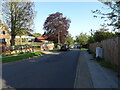
Photos of IP1 4LE


Area Information
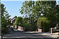
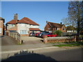
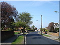
Living in IP1 4LE means being part of a tightly knit residential cluster in eastern England. This small area covers 5,317 square metres and is home to 1,533 people, resulting in a remarkably high population density of 288,345 people per square kilometre. The compact nature of the area creates a sense of community, with residents likely to know their neighbours. Daily life here is shaped by proximity to amenities and transport links. The area’s size means it is not sprawling, but its density suggests a focus on efficient land use. While the data does not specify local landmarks or historical context, the presence of nearby railway stations and retail outlets indicates a practical, functional environment. For those seeking a quiet, residential setting with access to essential services, IP1 4LE offers a balance of space and connectivity. The area’s demographics, with a median age of 47 and a high proportion of homeowners, suggest a stable, established community. Whether you are commuting or staying local, the area’s compact footprint ensures everything is within reach.
- Area Type
- Postcode
- Area Size
- 5317 m²
- Population
- 1533
- Population Density
- 3570 people/km²
The property market in IP1 4LE is characterised by a high rate of home ownership—90% of residents own their homes. This suggests a stable, long-term community with limited rental activity, which may appeal to buyers seeking a secure investment. The accommodation type is predominantly houses, which are likely to be family homes given the median age of 47 and the presence of independent schools nearby. The small area size and high population density imply that properties are closely spaced, with limited scope for expansion. For buyers, this means the market is likely competitive, with demand concentrated on existing homes rather than new builds. The compact nature of the area also means that property values may be influenced more by proximity to amenities like schools and transport links than by size alone. Buyers should consider the limited land availability when evaluating long-term potential.
House Prices in IP1 4LE
No properties found in this postcode.
Energy Efficiency in IP1 4LE
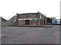
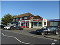
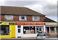
Residents of IP1 4LE have access to a range of nearby amenities, including five retail outlets, among them three branches of the East of England Co-operative Co. These shops likely provide essential goods and services, supporting daily living. The presence of multiple railway stations, such as Westerfield Railway Station and Entrance2, adds to the area’s practicality, enabling easy travel to nearby towns and cities. While the data does not mention parks or leisure facilities, the compact nature of the area suggests that local amenities are designed for convenience rather than scale. The mix of retail and transport options indicates a functional, community-focused environment. For those valuing accessibility, the proximity of shops and stations means daily errands and travel are efficiently managed without long commutes.
Amenities
Schools
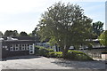
The nearest school to IP1 4LE is The Meadows Montessori School, an independent institution with an Ofsted rating of ‘good’. This suggests a high standard of education, though the data does not specify the school’s age range or student numbers. The presence of an independent school may attract families seeking alternative educational approaches, though no state schools are listed in the data. The absence of additional schools means that families may need to look beyond the immediate area for secondary education or specialist provisions. For those prioritising school quality, The Meadows Montessori School offers a notable option, but parents should verify its curriculum and facilities to ensure it meets their needs. The single school listed indicates a limited local choice, which could be a consideration for families with specific educational preferences.
| Rank | School | Type | Entry gender | Ages |
|---|---|---|---|---|
| 1 | The Meadows Montessori School | independent | N/A | N/A |
Explore more schools in this area
Go to Schools tabDemographics
The population of IP1 4LE is predominantly adults aged 30–64, reflecting a mature, working-age demographic. The median age of 47 indicates a community with a strong presence of middle-aged residents, many of whom may be in their peak earning years. Home ownership is exceptionally high at 90%, suggesting a long-term commitment to the area and a stable housing market. The accommodation type is primarily houses, which aligns with the high ownership rate and implies a preference for family homes or larger properties. The predominant ethnic group is White, though no specific diversity statistics are provided. The absence of data on deprivation or income levels means the area’s economic profile remains unclear, but the high home ownership and age profile suggest a relatively affluent, settled population. For buyers, this demographic mix may indicate a low turnover of properties and a focus on long-term residency.
Household Size
Accommodation Type
Tenure
Ethnic Group
Religion
Household Composition
Age
Household Deprivation
NS-SEC
Explore more demographic insights in this area
Go to Demographics tabPlanning
Planning Constraints
- Flood RiskPremium
- Ramsar Wetland SitesPremium
- Area of Outstanding Natural BeautyPremium
- Protected Nature ReservePremium
- Protected WoodlandPremium
- Crime RiskPremium