Area Overview for IP1 4JB
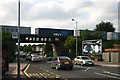
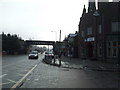
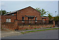
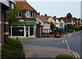
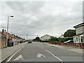
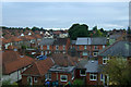
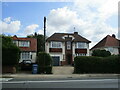
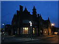
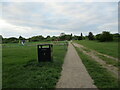
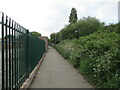
Photos of IP1 4JB


Area Information
Living in IP1 4JB offers a quiet, residential experience within a small cluster of homes. With a population of 1998, the area is compact but well-served by essential services. The community is predominantly composed of adults aged 30–64, suggesting a stable, established demographic. Daily life here is shaped by proximity to local amenities and transport links. The area’s low flood risk and absence of environmental constraints like protected woodlands or AONB designations mean residents face minimal planning restrictions. While the postcode covers a limited number of properties, its strategic location near rail stations and retail hubs makes it practical for commuters and families. The mix of housing types, though primarily houses, reflects a balance between private ownership and rental availability. For those seeking a settled, low-risk environment with access to nearby infrastructure, IP1 4JB provides a straightforward, no-frills living option.
- Area Type
- Postcode
- Area Size
- Not available
- Population
- 1998
- Population Density
- 8642 people/km²
The property market in IP1 4JB is characterised by a 55% home ownership rate, suggesting a balance between owner-occupied homes and rental properties. The area’s housing stock is primarily composed of houses, which may indicate a preference for family-friendly or spacious living compared to flats. Given the small scale of the postcode area, the market is likely limited in scope, with properties concentrated in a compact cluster. Buyers should consider that the area’s housing is not part of a larger urban sprawl but rather a defined residential cluster. The predominance of houses may appeal to those seeking more private, low-density living, though the limited number of properties could mean competition for available homes. Proximity to rail stations and retail amenities may enhance the area’s appeal for commuters or those prioritising connectivity over expansive housing options.
House Prices in IP1 4JB
No properties found in this postcode.
Energy Efficiency in IP1 4JB
Residents of IP1 4JB have access to a range of nearby amenities, including five retail outlets such as Tesco Ipswich and East of England Co-operative Co. These shops provide everyday essentials, reducing the need for longer trips to larger centres. The presence of multiple rail stations, including Entrance and Westerfield Railway Stations, adds convenience for commuting or leisure travel. While the area lacks detailed information on parks or leisure facilities, the retail and transport options suggest a practical, community-focused lifestyle. The compact nature of the postcode means amenities are within practical reach, supporting a self-contained daily routine. For those prioritising convenience and connectivity, the combination of shopping, rail access, and digital infrastructure makes IP1 4JB a functional choice for everyday living.
Amenities
Schools
The nearest schools to IP1 4JB include Springfield Infant School and Nursery, which operates as both a primary school and an academy. These institutions serve the local community, offering education for younger children. The presence of an academy suggests a school with some degree of autonomy in its governance and curriculum. While no Ofsted ratings are provided, the dual designation of the school as both a primary and academy may indicate a focus on early education and structured learning. For families, the availability of a local primary school reduces the need for long commutes, though parents may need to consider additional educational options for older children. The concentration of schools in the area reflects its role as a residential hub for families with young dependents.
| Rank | School | Type | Entry gender | Ages |
|---|---|---|---|---|
| 1 | Springfield Infant School and Nursery | primary | N/A | N/A |
| 2 | Springfield Infant School and Nursery | academy | N/A | N/A |
Explore more schools in this area
Go to Schools tabDemographics
The population of IP1 4JB has a median age of 47, with the majority of residents falling within the 30–64 age range. This suggests a community of middle-aged adults, likely with established careers and family commitments. Home ownership rates stand at 55%, indicating a mix of owner-occupied properties and rentals. The area is predominantly composed of houses, which may appeal to families seeking more space than flats. The predominant ethnic group is White, reflecting a homogenous demographic profile. While no specific data on deprivation is provided, the age range and home ownership figures imply a stable, middle-income population. This profile may influence local services and amenities, tailored to the needs of adults and families rather than younger or older demographics.
Household Size
Accommodation Type
Tenure
Ethnic Group
Religion
Household Composition
Age
Household Deprivation
NS-SEC
Explore more demographic insights in this area
Go to Demographics tabPlanning
Planning Constraints
- Flood RiskPremium
- Ramsar Wetland SitesPremium
- Area of Outstanding Natural BeautyPremium
- Protected Nature ReservePremium
- Protected WoodlandPremium
- Crime RiskPremium