Area Overview for IP1 3TG
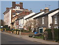
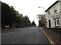
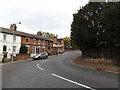
Photos of IP1 3TG


Area Information
IP1 3TG is a small, tightly knit residential postcode in England, home to 1409 residents. Its compact size means it feels more like a close-knit community than a sprawling suburb. The area’s character is defined by its quiet, residential nature, with houses forming the predominant accommodation type. Daily life here is shaped by proximity to key amenities, including retail hubs like Tesco St. and M&S Ipswich, as well as rail links such as Ipswich Railway Station. The median age of 47 suggests a stable population, with many residents in their prime working years. Living in IP1 3TG offers a balance of convenience and tranquillity, with easy access to urban services without the congestion of larger towns. The area’s low crime risk and lack of environmental constraints make it appealing for families and professionals seeking a secure, manageable environment. For those prioritising practicality, the postcode’s proximity to major transport routes and high broadband quality ensures modern connectivity without sacrificing a sense of place.
- Area Type
- Postcode
- Area Size
- Not available
- Population
- 1409
- Population Density
- 2858 people/km²
The property market in IP1 3TG is characterised by a high rate of home ownership (79%) and a focus on houses rather than flats or apartments. This indicates a market where owner-occupation is the norm, with limited rental activity. The prevalence of houses suggests a preference for standalone properties, which may appeal to families or professionals seeking space and privacy. Given the small size of the postcode, the immediate surrounding area likely offers a limited number of properties, making it a niche market. Buyers should consider the area’s compact nature, which may restrict property choices but also foster a close-knit community. The absence of planning constraints or protected land means development restrictions are minimal, though the small population suggests a low turnover of properties.
House Prices in IP1 3TG
No properties found in this postcode.
Energy Efficiency in IP1 3TG
Living in IP1 3TG offers access to a range of practical amenities within easy reach. Retail options include major stores such as Tesco St., M&S Ipswich, and Iceland Ipswich, providing everyday shopping needs. The area’s rail connections, including Ipswich Railway Station, facilitate commuting to nearby towns and cities. While parks and leisure facilities are not explicitly listed, the absence of protected natural areas suggests a focus on urban convenience rather than rural recreation. The combination of retail hubs and transport links creates a lifestyle that prioritises accessibility and efficiency, making it ideal for those who value proximity to services without the need for long commutes.
Amenities
Schools
The nearest school to IP1 3TG is Ipswich School, an independent institution. While no Ofsted rating is provided, its status as an independent school may indicate a focus on private education, which could be a draw for families prioritising specific curricula or facilities. The area lacks state schools, which may influence decisions for households seeking public education options. For those considering IP1 3TG, the presence of an independent school highlights the area’s alignment with communities valuing private schooling. However, buyers should verify whether the school’s intake policies and proximity to the postcode meet their needs, as the data does not specify travel times or enrollment criteria.
| Rank | School | Type | Entry gender | Ages |
|---|---|---|---|---|
| 1 | Ipswich School | independent | N/A | N/A |
Explore more schools in this area
Go to Schools tabDemographics
The population of IP1 3TG is predominantly adults aged 30–64, with a median age of 47. This suggests a mature, established community with a strong presence of working-age residents. Home ownership is high, at 79%, indicating a stable housing market where most residents live in their own homes rather than renting. The accommodation type is exclusively houses, which aligns with the area’s residential character. The predominant ethnic group is White, reflecting a homogenous demographic profile. The absence of specific deprivation data means no direct commentary on economic disparity, but the high home ownership rate and age distribution imply a relatively stable socioeconomic environment. For buyers, this demographic structure suggests a community with long-term residency patterns and a focus on family-oriented living.
Household Size
Accommodation Type
Tenure
Ethnic Group
Religion
Household Composition
Age
Household Deprivation
NS-SEC
Explore more demographic insights in this area
Go to Demographics tabPlanning
Planning Constraints
- Flood RiskPremium
- Ramsar Wetland SitesPremium
- Area of Outstanding Natural BeautyPremium
- Protected Nature ReservePremium
- Protected WoodlandPremium
- Crime RiskPremium