Area Overview for IP1 3SL
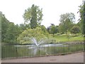
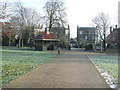
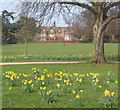
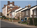
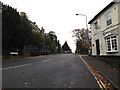
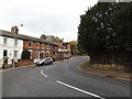
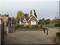
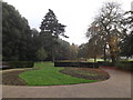
Photos of IP1 3SL


Area Information
Living in IP1 3SL means residing in a compact residential cluster defined by its specific postcode coverage. This small area spans merely 1.6 hectares, creating an environment where neighbourhood familiarity dominates daily life. The population of 1,347 residents populates this space with a density of 1,292 people per square kilometre. Such a concentration fosters a tight-knit community where local interactions are frequent and personal knowledge of the immediate surroundings is common. Residents primarily occupy houses within this defined boundary, establishing a consistent residential character distinct from higher-density urban zones. The area functions as a stable environment for those seeking a settled lifestyle rather than bustling city energy. You will find that daily life here revolves close to home, with a strong emphasis on the properties that line the local streets. This compact nature ensures that you are never far from your neighbours, yet the low overall population maintains a sense of quiet order. The demographic profile suggests a mature community where long-term residents shape the local culture. Understanding the scale of IP1 3SL helps you appreciate why connectivity and immediate amenities become vital for practical daily living. This small footprint defines the experience of ownership and neighbourly relations in this specific slice of England.
- Area Type
- Postcode
- Area Size
- 1.6 hectares
- Population
- 1347
- Population Density
- 1292 people/km²
The property market in IP1 3SL is defined by a stock almost entirely composed of houses. With 79% of residents being home owners, the area presents itself as a stable, owner-occupied environment rather than a location dominated by private rentals. This high ownership percentage indicates that most households have purchased their properties and are likely looking to maintain or improve their living situation rather than move frequently. The predominant accommodation type of houses suggests a landscape of detached or semi-detached living rather than apartments or terrace conversions. Such a market appeals to buyers who prioritise space and privacy over the density of flat living. You will find that the housing stock serves families and individuals seeking to establish roots in a specific location. The low population density of 1,292 people per square kilometre supports this model, as large estates do not require high-density housing solutions. This market structure means that price per square metre may vary differently than in high-rise blocks, often reflecting garden space or land size instead of just internal square footage. Buyers entering this market should anticipate purchasing properties suited to long-term stays, given the high rate of existing ownership. The area does not feature a significant student or transient rental sector, which stabilises prices and community expectations.
House Prices in IP1 3SL
No properties found in this postcode.
Energy Efficiency in IP1 3SL
Your daily lifestyle in IP1 3SL benefits from a practical range of amenities within easy reach, despite the area's small size of 1.6 hectares. Five railway stations, including Ipswich Railway Station, Westerfield Railway Station, and an Entrance point, provide rail access to broader networks. This transport diversity suggests good external connectivity via train rather than just local bus services. For retail needs, you are close to major supermarkets such as Tesco located in St., Iceland in Ipswich, and M&S in Ipswich. These five retail options ensure that grocery shopping and household necessity purchases require minimal travel through the area. The presence of these well-known chains indicates a reliable supply of fresh food and general goods without the need for extensive driving. Local shoppers value the convenience of accessing these major stores quickly from their homes. The combination of rail options and nearby high-street retailers creates a functional lifestyle where daily errands, commuting, and shopping coexist efficiently. You do not need to travel far beyond your immediate neighbourhood to access essential services. This balance of local convenience and external reach defines the practical advantages of living in this postcode. Residents appreciate not having to travel far for basics while maintaining access to larger town centres for wider shopping needs.
Amenities
Schools
| Rank | School | Type | Entry gender | Ages |
|---|
Explore more schools in this area
Go to Schools tabDemographics
The community in IP1 3SL is characterised by a mature demographic profile with a median age of 47 years. Adults between the ages of 30 and 64 constitute the most common age range, indicating a neighbourhood settled by individuals in their established prime working years. This age distribution contrasts sharply with families raising young children or the very young at heart of retirement. Home ownership stands at an exceptionally high level of 79%, meaning the vast majority of residents have purchased their accommodation. This statistic confirms that the area functions primarily as a settled market rather than a rental hub. The predominant accommodation type consists of houses, aligning with the preferences of these established households. While the area is predominantly white, the high home ownership rate and stable age profile suggest a community focused on long-term residence and stability rather than transient living. You can expect to encounter neighbours who have invested significantly in their local environment. The lack of young families or elderly-only clusters suggests a balanced, established social fabric where families may be in the middle stages of their lifecycle. This stability often translates to consistent local governance and well-maintained shared spaces. The demographic reality suggests you are looking at a neighbourhood where residents value permanence over quick turnover.
Household Size
Accommodation Type
Tenure
Ethnic Group
Religion
Household Composition
Age
Household Deprivation
NS-SEC
Explore more demographic insights in this area
Go to Demographics tabPlanning
Planning Constraints
- Flood RiskPremium
- Ramsar Wetland SitesPremium
- Area of Outstanding Natural BeautyPremium
- Protected Nature ReservePremium
- Protected WoodlandPremium
- Crime RiskPremium