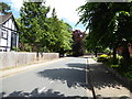
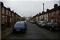
Area Overview for IP1 3NT
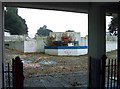
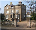
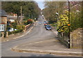
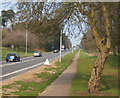
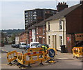
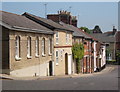
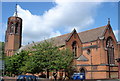
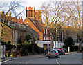
Photos of IP1 3NT


Area Information
Living in IP1 3NT offers a compact, residential experience shaped by its small cluster of homes and proximity to key services. With a population of 2014, this postcode area reflects a tight-knit community where daily life is influenced by nearby amenities and transport links. The area is characterised by a predominance of flats, catering to a demographic where adults aged 30–64 form the largest age group. While the population is modest, the presence of multiple retail outlets and rail stations within reach suggests practicality for both shopping and commuting. The area’s lack of natural constraints, such as protected woodlands or Areas of Outstanding Natural Beauty, means development is unencumbered, though it also lacks the scenic appeal of more rural settings. For those prioritising connectivity, the high broadband score and accessible rail networks make IP1 3NT a viable option for remote workers or commuters. However, the high crime risk score of 16/100 underscores the need for vigilance. This postcode is not for those seeking isolation; it is a place where convenience and proximity to services are balanced against the realities of urban living.
- Area Type
- Postcode
- Area Size
- Not available
- Population
- 2014
- Population Density
- 10776 people/km²
The property market in IP1 3NT is defined by a low home ownership rate of 20%, indicating that the majority of residents rent rather than own their homes. The accommodation type is predominantly flats, which may suggest a focus on high-density housing or older developments. This dynamic positions the area as more of a rental market than an owner-occupied one, potentially limiting opportunities for buyers seeking long-term investment. For those considering property in this small postcode, the availability of flats may mean fewer options for larger homes or bespoke renovations. The compact nature of the area also means that the immediate surroundings are critical for buyers, as the local housing stock is unlikely to expand significantly. Prospective buyers should weigh the practicality of renting against the challenges of a limited property market, particularly if they are seeking a home that appreciates in value over time. The flat-dominated landscape may appeal to those prioritising affordability and proximity to services, but it may not suit those desiring more space or a traditional house.
House Prices in IP1 3NT
No properties found in this postcode.
Energy Efficiency in IP1 3NT
Residents of IP1 3NT have access to a range of nearby amenities that support daily life, from retail to transport. The area includes five retail outlets, such as Tesco St., Farmfoods Westbourne, and Iceland Ipswich, providing essential shopping options within practical reach. These stores cater to everyday needs, from groceries to household items, reducing the need for long trips to larger centres. The rail network is equally well-served, with five stations offering connections to Ipswich and beyond, making commuting or travel to nearby destinations straightforward. While the area lacks expansive parks or leisure facilities, the presence of multiple rail stations and retail options suggests a focus on convenience over expansive recreational spaces. For those prioritising practicality, the combination of shops and transport links ensures that daily errands and travel are manageable without significant time or effort. The compact nature of the area means that amenities are concentrated, which can be both a benefit and a limitation, depending on individual preferences for space and variety.
Amenities
Schools
The schools near IP1 3NT include a mix of special, independent, and other educational institutions, though no traditional state schools are listed. Westbridge Pupil Referral Unit and Westbridge Academy are described as “other,” which may indicate alternative or specialist provision. West Lodge School is a special school, likely catering to students with specific needs, while Prospect School is an independent institution, suggesting it is fee-paying. This combination of school types means families have access to niche or specialist education but may lack the broader range of state-funded options. For parents seeking mainstream schooling, the absence of a comprehensive state school in the immediate area could be a concern. The presence of an independent school may appeal to those prioritising private education, but it also highlights the limited diversity of educational choices. Residents should consider whether the available schools align with their children’s needs, particularly if they require mainstream or specialist support.
| Rank | School | Type | Entry gender | Ages |
|---|---|---|---|---|
| 1 | Westbridge Pupil Referral Unit | other | N/A | N/A |
| 2 | West Lodge School | special | N/A | N/A |
| 3 | Prospect School | independent | N/A | N/A |
| 4 | Westbridge Academy | other | N/A | N/A |
Explore more schools in this area
Go to Schools tabDemographics
The community in IP1 3NT is predominantly composed of adults aged 30–64, with a median age of 47. This suggests a mature population, likely with established careers and families. Home ownership is relatively low at 20%, indicating that a significant portion of residents rent their accommodation. The accommodation type is primarily flats, which may reflect a mix of older housing stock or purpose-built residential blocks. The predominant ethnic group is White, though the data does not specify further diversity metrics. The absence of detailed deprivation data means it is unclear how economic factors influence quality of life here, but the high crime risk score of 16/100 implies that safety concerns may affect residents’ sense of security. The demographic profile points to a stable, middle-aged population, but the low home ownership rate and reliance on rental housing suggest a transient element to the community. This balance of stability and mobility shapes the area’s character, where daily life is influenced by both long-term residents and those in temporary housing.
Household Size
Accommodation Type
Tenure
Ethnic Group
Religion
Household Composition
Age
Household Deprivation
NS-SEC
Explore more demographic insights in this area
Go to Demographics tabPlanning
Planning Constraints
- Flood RiskPremium
- Ramsar Wetland SitesPremium
- Area of Outstanding Natural BeautyPremium
- Protected Nature ReservePremium
- Protected WoodlandPremium
- Crime RiskPremium