Area Overview for IP1 2PD
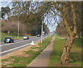
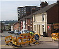
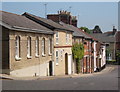
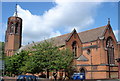
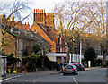
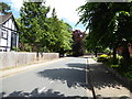
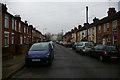
Photos of IP1 2PD

Area Information
IP1 2PD represents a small residential cluster within the wider Ipswich postcode district. This specific area covers just 2074 square metres, creating a dense living environment where residents are in close proximity to one another. The locality houses a population of 2014 people, resulting in an exceptionally high population density of 970861 people per square kilometre. Such density indicates a compact zone where land use is intensive and immediate neighbours are always present. Living in IP1 2PD means you navigate a space where every square metre is occupied by habitation rather than open green space or industrial zones. This concentration of homes suggests a neighbourhood defined by immediate convenience rather than sprawling suburbs. Daily life here involves frequent interaction with neighbours due to the minimal distance between properties. While the area offers the practical benefits of a tight-knit setting, the sheer population pressure against the tiny land area defines the physical character of the zone. Prospective buyers must accept this compact nature as the fundamental reality of residing within these boundaries. The area functions as a tightly packed extension of the larger IP1 postcode region, prioritising residential volume over spatial expansion.
- Area Type
- Postcode
- Area Size
- 2074 m²
- Population
- 2014
- Population Density
- 10776 people/km²
The housing stock in IP1 2PD is defined by a significant shortage of owner-occupied homes, with only 20% of residents owning their property outright. This figure indicates that the vast majority of the housing supply consists of rental accommodations. The predominant accommodation type is flats, which matches the high population density found within the 2074 square metre area. For buyers considering homes in IP1 2PD, the primary reality is a market controlled by landlords and letting agents rather than owner-occupiers. The lack of ownership suggests that direct purchases of freehold or leasehold homes here are rare compared to the volume of private and social tenancies. This market structure means that investors and those looking to generate rental income should view this postcode cluster as a potential opportunity. Conversely, first-time buyers seeking to secure a property for long-term residence may find fewer available stock options than in neighbouring open spaces. The concentration of flats implies that any properties selling off the market will be upper-floor units or ground-level apartments rather than detached houses with gardens.
House Prices in IP1 2PD
No properties found in this postcode.
Energy Efficiency in IP1 2PD
Your daily life in IP1 2PD revolves around a tight network of retail outlets and transport hubs located within practical reach. Farmfoods Westbourne, East of England Co-operative Co, and Tesco Ipswich serve as your key shopping destinations for groceries and essentials. These five retail outlets provide the staple shopping needs without requiring an extended journey. For those needing to commute to work, five railway stations lie close by, including Ipswich Railway Station and Westerfield Railway Station. These rail links connect you to broader city centres and outlying towns. The proximity to these transport nodes is a defining feature of your lifestyle here. You can grab morning coffee before heading to the high street at Tesco Ipswich or catch a train directly from the nearby entrance points. This blend of retail and rail access creates a functional day-to-day routine. While the area lacks the space for large leisure parks or gyms, the convenience of reaching a Co-op or the main station is within easy reach. Your neighbourhood life is structured around these five key retail and transport assets.
Amenities
Schools
Families living in IP1 2PD have access to a specific selection of educational institutions nearby, though options are limited to specialist and independent providers. The Westbridge Pupil Referral Unit operates as an alternative provision school catering to students who face barriers to mainstream attendance. West Lodge School also functions as a special education institution within close reach of the cluster. Prospect School provides an independent education choice for local families seeking a different curriculum model. Westbridge Academy serves as another nearby option for alternative or further education needs. The absence of standard primary or secondary schools in the immediate data suggests that families with young children or teenagers in standard age groups must look further afield for mainstream schooling. These four institutions represent the closest educational resources available. They cater to specific educational needs rather than the general school roll, reflecting the specialised nature of the local supply. Parents must carefully consider travel distances and transport requirements when evaluating these schools for their children. The mix of special and independent provision indicates a neighbourhood that may appeal more to specific demographics than to those seeking comprehensive local academies.
| Rank | School | Type | Entry gender | Ages |
|---|---|---|---|---|
| 1 | Westbridge Pupil Referral Unit | other | N/A | N/A |
| 2 | West Lodge School | special | N/A | N/A |
| 3 | Prospect School | independent | N/A | N/A |
| 4 | Westbridge Academy | other | N/A | N/A |
Explore more schools in this area
Go to Schools tabDemographics
The community within IP1 2PD is dominated by adults aged between 30 and 64 years, making this the most common age range in the cluster. The median age for residents is 47, confirming that the area attracts established individuals rather than young families or retirees. With a home ownership rate of only 20%, the majority of dwellings are occupied by tenants rather than owners. This statistic highlights that the market composition is heavily skewed towards renting. The predominant form of accommodation available consists of flats, which aligns with the high density and low ownership figures. Until recently, the demographic profile was overwhelmingly White, reflecting the historical patterns of development in this specific postcode segment. The combination of a median age of 47 and a high proportion of rented flats paints a picture of professional or working-age couples and individuals seeking urban-style living without the long-term commitment of buying a property. The low ownership rate suggests that many residents may be mobility-focused, viewing their tenancies as a stepping stone rather than a permanent settlement. Consequently, the local social fabric is likely dynamic, with regular changes in who occupies these specific flats.
Household Size
Accommodation Type
Tenure
Ethnic Group
Religion
Household Composition
Age
Household Deprivation
NS-SEC
Explore more demographic insights in this area
Go to Demographics tabPlanning
Planning Constraints
- Flood RiskPremium
- Ramsar Wetland SitesPremium
- Area of Outstanding Natural BeautyPremium
- Protected Nature ReservePremium
- Protected WoodlandPremium
- Crime RiskPremium